Intelligence Preparation Of The Operational Environment In The Subarctic
By Major Michael Everett
Article published on: December 10, 2024 in the Military Intelligence July–December 2024 Issue
Read Time: < 14 mins
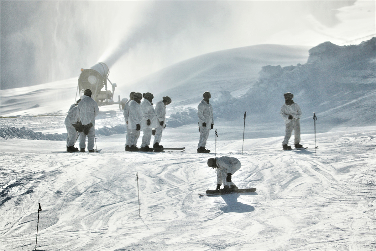
Students in the Fort McCoy Cold-Weather Operations Course start their skiing orientation and familiarization at Whitetail Ridge Ski Area, Fort McCoy, WI. (U.S. Army photo)
Introduction
Intelligence preparation of the operational environment (IPOE) is the fulcrum for all Army tactical intelligence support. It is the driving process for deliberate, effective, and efficient intelligence operations for brigade combat teams and lower echelons. During initial entry training, the Army teaches all-source military intelligence professionals about the four steps of IPOE. The Army then reinforces these foundational skills throughout their careers at most levels of professional military education. IPOE is a tried-and-true method for systematically assessing both the environment and the threat that produces outputs directly impacting all aspects of an operation.
Current IPOE doctrine, however, is lacking in one significant area: considerations for extreme environments, including the arctic, desert, and jungle environments. These operational environments (OEs) present unique challenges that require more careful consideration of their characteristics and effects by military intelligence professionals as they conduct IPOE. The four steps of IPOE and their outputs do not change; however, intelligence professionals must address the unique aspects of supporting operations in the extreme environment using a fundamentally different approach to IPOE.
This article specifically addresses the unique qualities of the subarctic environment. The subarctic is not simply a cold climate; it is an extreme environment with rugged mountainous terrain, glaciers, and novel hazards such as avalanches and temperature inversions. Geographically, the subarctic zone lies between latitudes 50°N and 66°33'N, just south of the Arctic Circle.1 Many of the most strategically important territories in Alaska, northern Europe, and northern Canada fall within this band. Because operations further north in the Arctic Circle would be difficult to sustain for a significant period, the subarctic is the most likely setting for any conflict in the far north.
Preparing for IPOE: Pre-Mission Analysis
To perform IPOE and the other important intelligence tasks that support operations, the intelligence staff must conduct a significant amount of analysis before receipt of mission.2
Research and pre-mission analysis are necessary before conducting IPOE in any environment, but they are critical in an extreme environment like the subarctic. Preparatory research fosters a comprehensive understanding of the OE throughout the IPOE process. Reviewing manuals on cold weather operations from prior conflicts allows analysts to draw on lessons learned, and it provides valuable insight into how armies have overcome the unique challenges presented by past cold weather maneuvers. For example, the German Handbook on Winter Warfare3 and the U.S. Army Corps of Engineers' Special Report 93-12: On Winter Warfare4 provide a good baseline on the environment's impact on warfighting. When reviewing these and other similar documents, analysts should focus on the aspects of the OE that make these environments different and make note of which strategies were most successful.
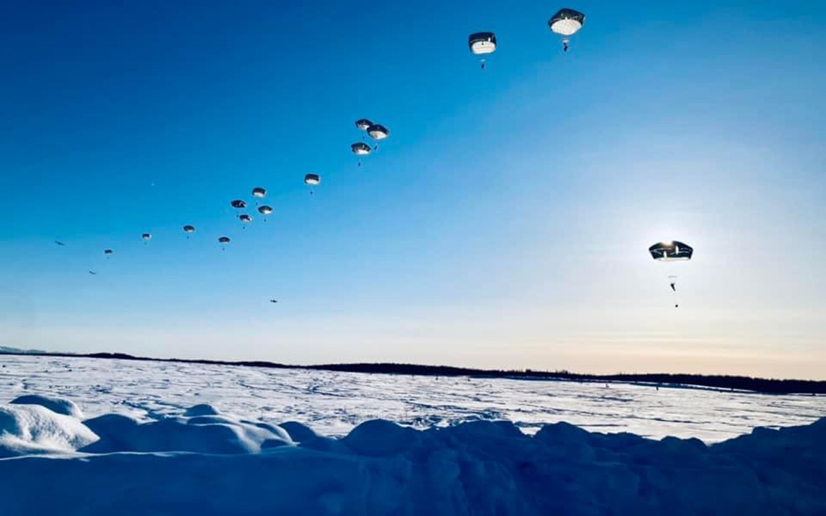
Paratroopers from the 2nd Infantry Brigade Combat Team, 11th Airborne Division jump onto the Malemute Drop Zone, Joint Base Elmendorf-Richardson, AK. (Photo by CPT Michael Everett)
The value of old doctrine, publications by service schools (e.g., Northern Warfare Training Center in Black Rapids, Alaska), and nonfiction literature should not be underestimated. Publications like these encompass a wide variety of experiences and information and can provide a wealth of knowledge on the subarctic. These documents add value because they not only present the unique operational challenges posed by these environments, but they also offer valuable solutions to those challenges.
Although few conflicts have transpired in the subarctic, historical information is available on, for example, the Russo-Finnish War and multiple conflicts in Scandinavia throughout history. The unique consideration for IPOE in this extreme environment is that the military challenges rarely change at the pace of those in a temperate climate. Regardless of technological advances, the elements are always the most significant challenge, and the lessons learned in the 13th century are as relevant today as they were then.
IPOE Step 1: Define the Operational Environment
During step 1 of the IPOE process, the intelligence staff identifies for further analysis the significant characteristics of or activities within the OE that may influence friendly and threat COAs [courses of action] and command decisions, as well as the physical space the mission will occupy. Within an OE, Army forces may face large-scale ground combat operations, which simultaneously encompass multiple domains, military engagements, and populations.5
A unit's higher headquarters designates its area of operations (AO). In the subarctic, expect unit boundaries to follow mountain ridgelines, valleys, rivers, and other challenging terrain features. These are natural boundaries in a sparsely populated environment that lacks extensive road networks and contains pronounced terrain features.
The AO overview should highlight significant terrain features and address realistic time-space analysis. This approach considers the current snow depth, upcoming weather, terrain slope, road or trail conditions, and friendly and threat over-the-snow movement capability. A general analysis is not sufficient, however. This level of analysis during IPOE step 1 requires some information not identified until step 2; therefore, an analyst must return later to the step 1 analysis to update the information.
The area of interest will impact the difficulty of traveling over long distances. Threat units will not be as capable of reinforcement or mutual support over long distances as they would be in a less restrictive environment. Depending on the road networks, weather conditions, and over-the-snow capability of the threat, it can take days for mounted elements and weeks for dismounted elements to traverse a 200-kilometer straight-line distance in the subarctic. The logic learned during initial entry training or other professional military education cannot be applied to extreme environments. The tactical commander will issue their planning guidance based on the time-space analysis presented during the briefing on the area of interest. Unrealistic timelines desynchronize a friendly operation before the line of departure.
IPOE Step 2: Describe Environmental Effects on Operations
Step 2 of the IPOE process determines how significant characteristics of the OE can affect friendly and threat operations. The staff begins evaluation by analyzing existing and projected conditions in the AO and AOI [area of interest], and then determining effects on both friendly and threat operations.6
Extreme operational environments have a significant impact on step 2. This is where a mission analysis brief can add the most value. It is also a crucial step early in an operation, before extensive, on-ground reconnaissance. The staff relies on a thorough analysis of all aspects of the OE that will affect them and their ability to support all elements of their warfighting functions. Terrain analysis in the subarctic will leverage standard IPOE methodology; however, analysts must consider additional niche factors to prepare Soldiers to face the most dangerous threat on the battlefield: the environment.
The subarctic experiences unique seasonal weather patterns that affect the terrain. Environmental trends suggest that summer or winter are the best times to conduct military operations in this region. Spring and fall are especially problematic due to the thaw-freeze cycle, known as “wet cold” (+39° F to +20° F).7 This cycle occurs when daytime temperatures are warm enough to melt snow and ice, and nighttime temperatures then freeze this standing water, creating hazardous and challenging conditions. The tactical intelligence officer must recognize and acknowledge this aspect of the OE and ensure that decision makers know the risks associated with military operations during this period. Vehicles will fail due to frozen parts or lines; weapons will malfunction more often due to frozen components; and service members will be at a higher risk of frostbite.8
Step 2 should also focus on tenable command posts, logistics nodes, firing positions, and tactical assembly area points in this environment. Finding these locations in the subarctic using imagery can be difficult because open areas may not be cleared of snow and winter debris. Imagery gathered within 12 to 24 hours is preferred (e.g., synthetic aperture radar or electro-optical overhead systems), as it can indicate where the threat has cleared the snow and suggest locations where friendly forces can establish positions. Soil composition and surface content, like gravel or pavement, can reveal suitable locations where vehicles will not continue to sink after snow clearance. This information is vital to commanders as it prevents the loss of mobility, provides options based on near real time information, and may signal the location of threat command posts, artillery, or logistics nodes. Requests to the geospatial intelligence cell should be made early and often to assist in proper analysis.
Elevation significantly affects operations in cold weather and mountainous regions like the subarctic. Providing topographic relief models and maps is critical to ensuring leaders understand the importance of topography to the operation. Topographic maps that display relief three-dimensionally offer the best means to illustrate the impact of elevation on the friendly force scheme of maneuver. Tools such as the Distributed Common Ground System-Army Capability Drop-1 or similar commercial-off-the-shelf software can provide reliable heat maps displaying land surface earth science data overlaid on maps of the Earth as elevation in two dimensions, such as hard copies or a PowerPoint presentation.9
Road accessibility is the most significant limiting factor when operating in the subarctic. Less terrain-restrictive environments allow for limited to extensive off-road movement for wheeled and tracked vehicles. When conducting IPOE step 2 in the subarctic, the most recent imagery and real-time reporting is the only reliable method of predicting route trafficability. Consider recent weather, civilian traffic in the area, and local snow removal capabilities. In the subarctic, roads will likely remain the only method to move standard Army vehicles (wheeled and tracked) across the terrain. Over-the-snow vehicles provide additional options and should be addressed in terrain analysis; however, do not assume that all over-the-snow vehicles can travel across all snow-covered landscapes. The snow's density, consistency, and degree of grooming will factor into the trafficability and speed at which an over-the-snow vehicle can move. Assess the local recreational and utility trail networks during mission analysis and initial IPOE. Reassess as the mission progresses to determine whether the trail network's accessibility is affected by weather conditions. To identify these trails, use local maps, overhead assets, and commercial applications designed for recreational activities. Knowing which trails are accessible and which are not is invaluable. Use intelligence reach and collaboration with other organizations to fill information gaps and clarify trafficability when possible.
Weather ties heavily to subarctic terrain conditions. The intelligence cell's ability to articulate the weather's impact in step 2 of IPOE is critical to its value. “A mountain environment is generally categorized as an area where altitude, relief, and weather significantly degrade normal military activities.…A cold weather environment is characterized by low temperatures, fog, freezing rain, snow, ice, frozen conditions, and a series of freeze and thaw cycles.”10The impact of temperature and precipitation can be deadly in the subarctic as it combines the dangers presented by mountainous terrain and cold weather. “Wet cold” tends to be more dangerous than any other condition except extreme cold.11
Overall, the subarctic contains frozen and non-frozen hydrology, snow drifts, snow accumulation, severely restricted off-road vehicular movement, ranging line of sight based on drastic elevation shifts, and minimal concealment in the winter months. This only scratches the surface of the challenges the staff face during IPOE step 2 in the subarctic; it can become the most crucial step to ensuring that friendly forces prepare physically, mentally, and materially for the challenges they will encounter. The staff should conduct extensive analysis that fully incorporates their understanding of the subarctic region's effects on threat forces and friendly operations.
IPOE Step 3: Evaluate the Threat
Step 3 of the IPOE process determines threat force capabilities and the doctrinal principles and TTP [tactics, techniques, and procedures] threat forces prefer to employ. This may include threats that create multiple dilemmas for U.S. maneuver forces by simultaneously employing regular, irregular, and terrorist forces and criminal elements, using a variety of traditional and nontraditional tactics.12
Under the intelligence staff's direction, the entire staff should participate in IPOE by analyzing their opposing force counterpart. This whole-of-staff analysis is a crucial element to the overall success of IPOE. The subarctic environment may include unique mission variables and uncommon aspects to threat models or key systems, making it impractical to rely solely on the S-2 section to analyze all relevant aspects of the threat. While a whole-of-staff analysis by warfighting function is an excellent method to get the staff sections involved in mission analysis and IPOE, it is even more essential in the subarctic. Each warfighting function requires unique templates with questions or prompts to generate relevant information to set a foundation for step 4. The intelligence staff should push these templates out at the beginning of mission analysis or IPOE, ensuring adequate time for each staff section to research, record, and produce quality products.
The threat templates also merit special attention. The OE Data Integration Network (ODIN) provides an adequate baseline for arctic capabilities and assets attributed to multiple nation-states.13 In addition to these real-world resources, ODIN offers the Decisive Action Training Environment scenario equivalent, which can assist S-2 sections in adapting their situation to the appropriate arctic threat.
In the subarctic, the intelligence staff must research over-the-snow vehicles and capabilities to understand how, where, and when the threat can move. How effective are specific types of over-the-snow vehicles in the distinct types of snow? How many over-the-snow vehicles does the threat have, and how will this change their task organization across all maneuver and support units? Extreme environments tend to be a laboratory for experimentation, leading to constant change and adaptation. The threat templates are important but avoid tunnel vision. The threat's task organization down to the lowest level will change as the enemy commander changes his tactics.
The subarctic also significantly affects key systems. Any vehicle or asset floating over or through the snow becomes essential; this does not only apply to troop movement and infantry fighting vehicles. Logistic support relies upon timely resupply at the edge of the battlefield, and vehicles such as the Small Unit Support Vehicle have proven invaluable for friendly force resupply and casualty backhaul. The threat will use similar vehicles in an equivalent manner. Radio retransmission, or retrans, in a snow-covered, mountainous environment will also require over-the-snow capability to ensure proper site emplacement for long-range, secure, line-of-sight voice communications. Reconnaissance elements must remain undetected, moving off route, and the only way to accomplish this in the subarctic is to use over-the-snow vehicles. However, intelligence analysts should not focus solely on movement and maneuver. Infantry Soldiers can walk on skis and snowshoes; food, water, fuel, and ammunition cannot–and that is where over-the-snow vehicles find their true value.
Although a threat template depicts a threat's actions without the impact of the mission variables discovered in steps 1 and 2,14 it is not prudent to use a typical threat template in an extreme environment. The topography is complex, the environmental conditions are unique, and the equipment used by the threat is often obscure. These factors contribute to an enemy playbook full of nonstandard threat templates that leverage creativity and the environment. Intelligence professionals should not dismiss the threat template but consider the unique challenges and assets presented. This will ensure a usable framework in step 4. Forcing the available threat templates to bend to the subarctic scenario will lead to failure.
Finally, the high-value target list, one of the culminating products of IPOE step 3, will likely emphasize over-the-snow capability at the tactical level above many of the more traditional tactical assets. Artillery, antiaircraft artillery, and command and control will remain essential to the enemy in the subarctic; nevertheless, moving on and accessing specific areas rely heavily on over-the-snow vehicles. Place these vehicles high on the high-value target list, especially if the asset is essential to resupply operations. Smaller vehicles, such as snowmobiles, may help move troops, but the threat commander can accomplish his mission without them. Larger tracked vehicles meant to move on snow are crucial for resupply and casualty evacuation. Consider these variables when populating the high-value target list.
IPOE Step 4: Determine Threat Courses of Action
4 of the IPOE process identifies and describes threat COAs [courses of action] that can influence friendly operations.15
The entire IPOE process converges at the threat course of action (COA). ATP 2-01.3, Intelligence Preparation of the Operational Environment, explicitly states that “the staff develops and prioritizes as many valid threat COAs as time allows but, at a minimum, develops the most likely and most dangerous COAs.”16 Due to time constraints, many S-2 sections elect to produce only two threat COAs during step 4. However, operations in the subarctic contend with so many variables that the most likely and most dangerous COA cannot adequately cover potential threat tactics. Limiting COAs to two leaves a significant gap in the possible threat actions and disregards the creativity the threat commander can use in extreme environments.
Time-space analysis and battlefield geometry become much more essential in subarctic operations. An obstacle may slow down or slightly alter an enemy's plan in a typical environment, but in the subarctic an obstacle can completely derail an operation. Snow, ice, and cold are enduring obstacles. Usually, they are not intentionally emplaced on a battlefield; in the subarctic, they are the battlefield. These environmental obstacles can cause a unit to abandon COAs completely. When conducting a time-space analysis using a map or other digital tools, it is prudent to overestimate the time a movement will take in subarctic conditions. Even over-the-snow vehicles can get bogged down and fail to move in specific types of dry snow. If the threat is on the offensive, do not assume they can move faster than 500 to 1500 meters per hour off-road, on foot, especially in hours of darkness. S-2 sections must access every piece of information available to determine the real-time,on-ground conditions and their impacts on the threat. The subarctic tends to fool even the best analysts into believing that conditions are much more tenable for movement than they truly are. Analysts should build these factors into their threat COAs, as the threat timeline will drive the friendly commander's decision cycle.
Conclusion
The subarctic is one of several extreme environments where intelligence professionals operate. Currently, there is no up-to-date manual highlighting special considerations for conducting IPOE in extreme environments, so the battalion and brigade S-2 section are responsible for adapting IPOE to the unique considerations of the subarctic at the tactical level. IPOE has a very scalable and adaptable framework. Still, military intelligence professionals working in the subarctic must think more creatively to adequately prepare their commanders and formations for the fight in this unforgiving environment.
Endnotes
1. U.S. Army Northern Warfare Training Center, “Cold Weather (CWLC, CWOC, & CWIC)” (student handout, Cold Weather Training Course Winter 2022-2023, Black Rapids, AK, 2022), 5-6.
2. Department of the Army, Field Manual 2-0, Intelligence (Washington, DC: Government Publishing Office [GPO], 1 October 2023), 5-13.
3. German Army High Command, Handbook on Winter Warfare, trans. and ed. U.S. War Department Military Intelligence Division (Washington, DC: U.S. GPO, 1943), https://archive.org/details/GermanWinterWarfare1943.
4. George K. Swinzow, Special Report 93-12: On Winter Warfare (Philadelphia, PA: U.S. Army Corps of Engineers Cold Regions Research & Engineering Laboratory, 1993), https://apps.dtic.mil/sti/pdfs/ADA270031.pdf.
5. Department of the Army, Army Techniques Publication (ATP) 2-01.3, Intelligence Preparation of the Operational Environment (Washington, DC: GPO, 1 March 2019) 3-1. Change 1 was issued on 6 January 2021. Change 2 was issued on 23 January 2024
6. Department of the Army, ATP 2-01.3, Intelligence Preparation of the Operational Environment, 4-1.
7. Department of the Army, ATP 3-90.97, Mountain Warfare and Cold Weather Operations (Washington,DC: GPO, 29 April 2016), 1-8.
8. Ibid.
9. “Earth Science Data Visualizations—How to Read a Heat Map,” Education, Jet Propulsion Laboratory California Institute of Technology, NASA, https://www.jpl.nasa.gov/edu/teach/activity/earth-science-data-visualizations-how-to-read-a-heat-map/.
10. Department of the Army, ATP 3-90.97, Mountain Warfare and Cold Weather Operations, 2-1.
11. Ibid., 1-8.
12. Department of the Army, ATP 2-01.3, Intelligence Preparation of the Operational Environment,5-1.
13. OE Data Integration Network (ODIN), U.S. Army Training and Doctrine Command, version 3.10.1, https://odin.tradoc.army.mil.
14. Department of the Army, ATP 2-01.3, Intelligence Preparation of the Operational Environment,5-18.
15. Ibid., 6-1.
16. Ibid., 6-7.
Authors
MAJ Michael Everett is currently attending the College of Naval Command and Staff for Intermediate Level Education. He previously served as the Military Intelligence Company Commander in the 2nd Infantry Brigade Combat Team (Airborne), 11th Airborne Division at Joint Base Elmendorf-Richardson (JBER), AK. Additionally, he served as the S-2 in 1st Squadron, 40th Cavalry at JBER, AK and as an assistant S-3, platoon leader, and executive officer in 1st Infantry Brigade Combat Team, 10th Mountain Division (Light Infantry) at Fort Drum, NY. He recently earned his master's degree in Intelligence Studies.