"Making War Upon the Map"
The U.S. Army’s Forgotten Map Problem, Meade’s Gettysburg Campaign, and Depicting Operational Art
By Thomas Bruscino and Mitchell G. Klingenberg
Article published on: April 1, 2024 in the Army History Spring 2024 issue
Read Time: < 60 mins
Maps of military campaigns, both in practice and historical, have never adequately depicted operational art. They have not shown how commanders of campaigns array their forces and arrange tactical actions in time, space, and purpose. This article tells how this shortcoming in campaign mapping came about, describes what proper historical campaign maps should include, and provides new operational maps from the Gettysburg Campaign to demonstrate how such maps can improve understanding and analysis of how campaigns are fought and won.
The Map Problem in the U.S. Army on the Eve of World War I
In the years before World War I, the United States Army line and staff schools at Fort Leavenworth, Kansas, and the War College in Washington, D.C., had a problem: “We had no military maps of any part of North America,” remembered one Fort Leavenworth graduate. “We groused bitterly because we had to use German maps of the Franco-German frontier in the area around Metz.”1 Indeed, students and faculty routinely lamented the absence of good maps. Maj. Gen. Fox Conner, the future American Expeditionary Forces operations officer and the mentor of both George C. Marshall and Dwight D. Eisenhower, famously grumbled about the lack of uniquely American maps.2 In fact, published lessons on military geography at Fort Leavenworth referred readers to the Encyclopedia Britannica, “it being impractical to illustrate [schoolhouse] lectures with suitable maps.”3
Half a century after his time at Fort Leavenworth, Marshall himself admitted that he and his peers had become more familiar with the Metz map, “very much more so than [with] any map [he] ever knew in this country.”4 Hunter Liggett, the great World War I corps and field army commander, recalled, “We used French and German maps for the most part at the Leavenworth schools and the War College, with the result that many of us found Western Germany, Lorraine and much of France as familiar as the hills and valleys of our boyhood.”5 John A. Lejeune, the first marine to attend the Army War College (and a graduate of the class of 1910), noted that early in his year there, the new commandant Maj. Gen. William W. Wotherspoon grew so exasperated with the ubiquitous German maps that he declared that, in the future, studies at the War College “would be directed towards those parts of the world where it was at least possible we might some day be called on to serve. Thenceforth,” Wotherspoon continued, “we devoted our attention to the continent of North America and the contiguous islands, to Hawaii and the Philippines, and to other theaters of possible operations.”6
Across the board, American officers of the World War I era pointed out the salutary irony that the maps they so grudgingly had studied ended up depicting the very ground over which they would fight the great campaigns of Saint-Mihiel and Meuse-Argonne in the war. Their comments, however, illustrated a more fundamental problem. At the great Army schools of the United States—and, in the case of the War College, located only a stone’s throw away from the ground on which the campaigns depicted in the memoirs of Ulysses S. Grant, William T. Sherman, and Philip H. Sheridan had been fought—students lacked proper military maps from which to study how American armies operated in their greatest of wars.
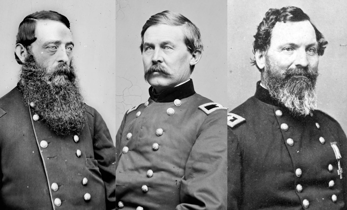
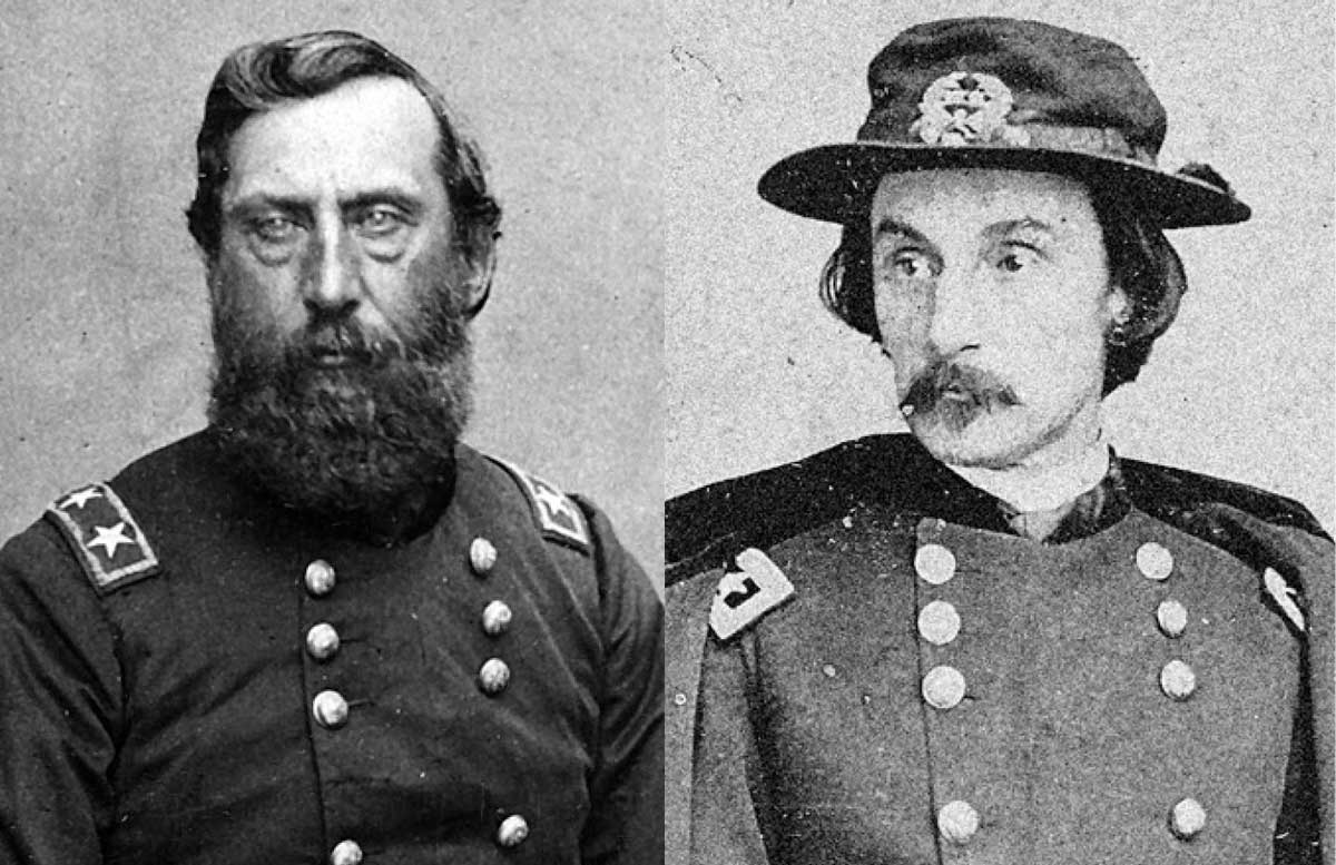 Left:General Hunt (National Archives) Right: General Warren (Library of Congress)
This lack of maps was not merely a problem at the schoolhouse before World War I. It also had been a problem for the Army in the field during the Civil War. Often, engineers acted as scouts, creating basic sketches of terrain to give commanders the information they required for sound decision making. For example, Robert E. Lee began building his military reputation by acting in such a capacity for Maj. Gen. Winfield Scott during the Mexico City campaign in 1847.7 Even in the Civil War, on familiar ground, the Americans generally lacked proper maps. What maps did exist varied wildly in quality. To better understand the maps they managed to procure or produce, soldiers supplemented them with direct observations by engineers, cavalry, local civilians, and even journalists.8 The intelligence gap between what maps depicted and what commanders needed to know for prudent decision making of course was evident throughout the far-flung theaters of the war, but it also existed in the well-populated and mapped East, even in key areas such as those traversed in the Gettysburg Campaign. Maj. Gen. George G. Meade, commander of the Army of the Potomac and a Pennsylvanian with some knowledge of the region and in possession of some maps, nevertheless had to dispatch important senior officers to scout the terrain. Most famously, he tasked the Army of the Potomac’s Chief of Artillery Maj. Gen. Henry J. Hunt and Chief of Engineers Maj. Gen. Gouverneur K. Warren with surveying a potential defensive line in northern Maryland.9 These officers managed to do so, but it was an ad hoc solution.10
After the Civil War, as U.S. Army officers attempted to improve their institutional deficiencies in mapmaking, the maturing Prusso-German staff system offered a solution. As part of their many reforms following the Napoleonic Wars, the Germans had developed a national-level general staff, including an accessory branch and then a survey department that possessed a cartographical section.11 This Great General Staff, in its broad outlines, became the foundation for general and field staffs and their operations the world over. Of course, the Americans did not copy the German model in its entirety. For one thing, and for the good reason that it smacked of militarism, the United States never created a national general staff with the full powers, responsibilities, and organizations of the German version. In 1903, the Americans organized the War Department General Staff, which included Second Division, a fledgling military information section tasked with furnishing a “system of war maps, American and foreign,” among its many responsibilities.12 More importantly, the Americans adopted the concept of field staffs being internal to line formations. Critically, however, these developing staffs lacked dedicated cartography sections until World War I. Additionally, outside of war, field armies, corps, and divisions existed only conceptually, meaning that even if American field general staffs had had cartography sections, there were no personnel staffing those sections in peacetime to do the work.
This is not to say the Americans ignored the problem of producing maps for war. To the contrary, the staff and war colleges taught mapmaking, but in a manner consistent with older methods of preparing officers for the traditional practice of producing maps in the field and as the situation demanded. The map section of the Second Division of the War Department General Staff assisted these efforts as best it could with limited resources in a contentious era of reform, but in the main, the basic problem persisted.13 Maj. Gen. Leonard Wood, Army chief of staff in 1909, authored a critique from his time in the Philippines in 1907 in which he remarked, “There is an apparent entire ignorance in the War Department concerning Subic Bay. No topographical maps exist; waiting on them now.”14 Schoolhouses tried to appropriate money for map production and procurement, but mapmaking efforts progressed only modestly because of the resource-constrained environment of the period from the Civil War to World War I.15
Nevertheless, U.S. military schoolhouses took note of the problem, and to prepare senior leaders and staffs for large-scale military campaigns, they procured the intricate and precise German maps. Thus, General Conner and his peers in the U.S. Army found themselves studying in detail these German-made maps of the ground around the French communities of Metz and Gravelotte and Saint-Mihiel and Verdun and Sedan. Though the course of military events from 1917 to 1918 vindicated the usefulness of the German maps for the American officers who fought in France, there was still something odd about the inability of the U.S. Army to develop maps from which to study the campaigns of the American Civil War—the greatest war in American history to 1917, and one fought in the proverbial backyard of the students who studied it.
The Problem of Perspective
Eventually, American schoolhouses did get better maps. In the first few decades of the twentieth century, they developed internal mapmaking capabilities and even enlisted support from the U.S. Geological Survey to produce topographical maps of places like Gettysburg, Pennsylvania, in appropriate detail for military use. However, because the military professionals involved wanted maps that would be useful in potential future conflicts, the resulting maps depicted key terrain and infrastructure without historical military formations. Military mapmakers, therefore, devoted less attention to depicting how military units had appeared on the ground while on campaign.16 This emphasis, while understandable, came with serious and far-reaching implications.
Lt. Gen. Hunter Liggett, a corps and field army commander in World War I, best described this conundrum. When assessing potential military problems from a strategic and operational perspective, Liggett believed it imperative to analyze “everything in the art of war—the supply, equipment, transport, mobilization of both troops and industries, recruiting, training, replacements, and disposition of the rapidly expanding army,” and to include, if necessary, “sea transport.”17 On the importance of good maps for the basis of such assessments, Liggett continued:
The first necessity of such theoretical fighting is absolutely complete and accurate maps. . . . The ordinary atlas map of commerce is no map at all to a soldier; it is made for the layman who is interested only in the relative location of Altus, Oklahoma, and Quanah, Texas, the approximate course of the main roads, railroads, perhaps the more important streams, and the imaginary state line. A railroad folder map on which the B.C. & D. is shown in geometrically straight lines and its competitors largely ignored would be only a little less useful in war. A proper military map is so intricately comprehensive that it is forbidding for ordinary lay uses; the untrained eye cannot see the forest for the trees.
The most complete map can be no more than a flat projection on the ground, but a good one gives a perfect perspective to those who know how to use it. If the trained eye cannot recognize every major feature of the landscape after an hour’s preparatory study of the projection, the map is of little value. It must be photographic in its accuracy; delineating, for example, every elevation, where the ordinary map is oblivious of anything less than a mountain range.18
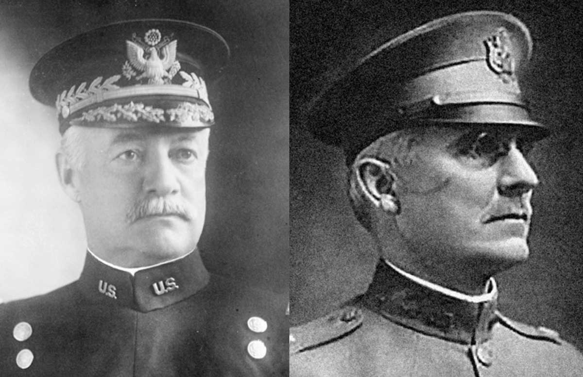 Left:Hunter Liggett, shown here as a major general (Library of Congress) Right: Matthew Forney Steele, shown here as a major (Courtesy of North Dakota State University Libraries)
This was not all of what reading a map entailed, however, as Liggett continued to explain. Having a detailed, comprehensive map alone was not enough. In fact, the ability to read a map well often meant the difference between success and failure in war. “Obviously, an officer cannot afford to guess at what lies over the hill from him,” Liggett wrote. “He should, in fact, be able, by study of the map, to foretell pretty nearly what his opponent will do and where he will go under any given condition.”19
In World War I, General John J. Pershing’s American Expeditionary Forces adopted the numbered general staff organizational structure that is still in use today. Well aware of the necessity of good military maps and building on the experiences of their French and British allies, the Americans embedded map production into their staffs. Yet this improved organization and the resulting procurement of better topographical studies did not make the planning or conduct of military operations easier.20 In fact, mapmaking for campaigns grew more complicated. It now entailed three broad categories that mirrored the staff organizational structure: intelligence, operations, and supply. The intelligence specialists focused on depicting enemy order of battle, movements, and dispositions. The operations section depicted friendly formations, movements, and plans. Those responsible for the logistics of the campaign had to illustrate friendly bases, lines of supply, depots, and distribution centers. As a result, each section of the American Expeditionary Forces’ staff—the G–2, G–3, and G–4—produced maps in World War I, and these maps reflected different planning considerations. Thus, so focused as they were on their own concerns and the various specifics of engagements and battles, staff officers never produced a synthesis—a comprehensive, overall campaign map—even for the massive Meuse-Argonne offensive.21
The problem of producing good maps for military use persisted in all theaters of World War II, the Korean War, and even the Vietnam War. In more recent years, the advent of satellite imagery has fundamentally transformed the Army’s ability to render accurate terrain and road features in military mapping. But Liggett’s observation—that a good map allows an officer to visualize what friendly and enemy forces can and will do on the terrain under certain conditions—points to something else missing from even the best maps: namely, the visualization of a battlespace that happens only in the officer’s head. For all its impressive accomplishments, to date the U.S. Army has never possessed a standard system for producing the kind of campaign maps that depict the dispositions and intentions of military forces—enemy and friendly, combat and support—from a field army commander’s purview.
Matthew Forney Steele, Vincent Esposito, and Pumped-Up Battle Maps
The story of how the U.S. Army makes its maps for war intersects with the story of how military professionals and historians have mapped historic campaigns. These maps also struggle to convey a thorough understanding of campaigning in war. Such a statement may seem incredible. Historians have plenty of battle maps—many, in fact, of tremendous quality—that more than suffice for understanding even vast tactical actions. Most military historians, while inquiring into operational-level warfare, have scrutinized so-called campaign maps in their study. Consider, for instance, the widely accepted, state-of-the-art maps that countless students of war have referenced through the years: the West Point atlases. Historians have used various versions of the atlases, either in print or in digital form from the United States Military Academy Department of History website. For good reason, they are the standard, and almost always excellent for battles. But the clarity with which these maps depict the tactical level of war is simultaneously lacking—or absent altogether—in their substandard depiction of armies on campaign.
These maps also have a history, which is rooted in the learning that happened at American military schools before World War I. Before 1914, Matthew Forney Steele, one of the great instructors at Fort Leavenworth, taught a course entitled The Conduct of War. In keeping with the theme then in vogue that American officers should study warfare only through the lens of the American experience in war, Steele structured his course around American campaigns. That course—and the lectures Steele delivered in it—became the foundation of his American Campaigns, a two-volume work published in 1909. The first volume contained many of Steele’s lectures; the second contained maps to accompany those lectures. Because no one then in the Army produced original maps depicting historic campaigns, Steele had to look elsewhere for maps to grace his text. None of the maps in American Campaigns were originals drawn for the express purpose of instructing students in the art of campaigning. Instead, Steele reproduced battle and campaign maps from a variety of published secondary sources, usually the volumes he relied on most to write his lectures. Because the book’s publication was to be paid for by the War Department and used primarily for educating officers, Steele wrote to, and received permission from, a variety of publishers and individuals to reproduce their maps.22
The Civil War dominated Steele’s work, accounting for 428 of the 627 pages of text in Volume 1 and over 230 of the 298 maps in Volume 2. Steele drew from several sources for those maps but leaned heavily on the maps contained in the multivolume series Battles and Leaders of the Civil War (1887–88). For instance, maps depicting the Gettysburg Campaign—thirty total—are original to the Battles and Leaders series. Those maps in turn first appeared in the Century Magazine from 1884 to 1887. Steele’s process of reproducing these maps involved a small team of draftsmen and photographers at Fort Leavenworth and attached to the Military Information Committee of the General Staff. They took close photographs of previously published maps and traced terrain and infrastructure from the photographs. The most original contribution used “colored blocks and lines representing troops and routes of march . . . specially for the lectures.”23 All such blocks appeared colored in blue and red. For the French and Indian War, Steele depicted French units in blue and the British in red. From the Revolutionary War onward, the Americans appeared in blue, and various enemies were depicted in red.24
Steele’s volumes proved influential in American professional military education (formal and informal) and beyond.25 Some copies went to overseas militaries, one set prompting German Chief of Staff Col. Gen. Helmuth von Moltke (the younger) to write that American Campaigns was “a much appreciated addition to the library of the General Staff, as it presents in an exceedingly skillful manner as well as instructive, the most essential matter of American War history, aided by splendid sketches.”26 In the late 1920s, the West Point Department of Civil and Military Engineering adopted Steele’s text. Several years later, what would become the Department of Military Art and Engineering adopted American Campaigns as a primary text for its History of Military Art course, focusing on the Civil War chapters, and continued to use the text until 1959. American Campaigns underwent several printings and editions—all of which included the second map volume—largely unrevised from edition to edition.27
In 1938, however, the academy began producing its own maps, beginning with Civil War campaigns, to accompany Steele’s text. In 1941, it published the first significant revision to Steele’s work—a dedicated volume of Civil War renderings.28 While the new study was larger, and somewhat different in matters of style and in depiction of units on the ground, the specific formations and key terrain details remained essentially unchanged.29 Steele’s work was largely ignored as the academy devoted more space in its curriculum to the campaigns of both world wars. Eventually, an officer named Vincent J. Esposito led a department-echelon effort to replace all of Steele’s works. In 1959, the department published its new, two-volume West Point Atlas of American Wars, complete with a preface from President Eisenhower. This atlas embedded campaign narratives replete with operational and tactical detail to accompany the maps. But even in this atlas, the Civil War maps were unchanged from the 1941 edition, following the distinctive Steele style for both battles and campaigns.30
In more recent versions and in subsequent volumes that have expanded to include non-American wars, editors have removed accompanying campaign narratives and analysis, leaving only the maps, but with less operational detail. Of the 2002 Civil War edition, series editor Thomas E. Griess wrote that because the West Point Civil War course “was modified to include more than purely operational military history, the treatment of the subject demanded compression and accommodation to course-long themes.” As a result, the current atlas “provide[d] less detailed graphical treatment than the Esposito text-atlas.”31
Given the imprimatur of the United States Military Academy and due, perhaps, to the widespread availability of the West Point atlases, they have become an industry standard for military historians. In American circles, these maps have been reproduced in numerous books, lectures, and presentations. When not reproduced as direct copies, the pattern and style of the West Point atlases remain, depicting combat units in mostly uniform shapes and in their rough proximity on the ground at given moments in time. For the purposes of undergraduate education at West Point, such maps have proven utility. Cadets who are decades removed from future senior commands first must learn tactics and the strategic situations of wars. In the process, they can acquire a feel for the overall course of a military campaign under review. But cadets also have neither the time nor the relevant experience and perspective to grasp what these atlases omit.
And therein lies the problem—and it is not a negligible one—which dates to the genesis of the atlas series. When Steele wrote American Campaigns, his readership was not cadets at the United States Military Academy, but rather midgrade officers preparing for command and staff work at higher echelons. With his focus, however, on campaign narratives, and given the paucity of military mapmaking capabilities at the time of his work, Steele did not have the capability to create new maps that depicted high command and staff perspectives that illustrated higher operational details in the campaigns under review. Instead, Steele reproduced maps from a popular magazine, and those maps reflected the common battle-map style. Despite subsequent revisions and updates made by various West Point instructors and reflected in the Esposito volumes, the battle-map style remained unchanged.
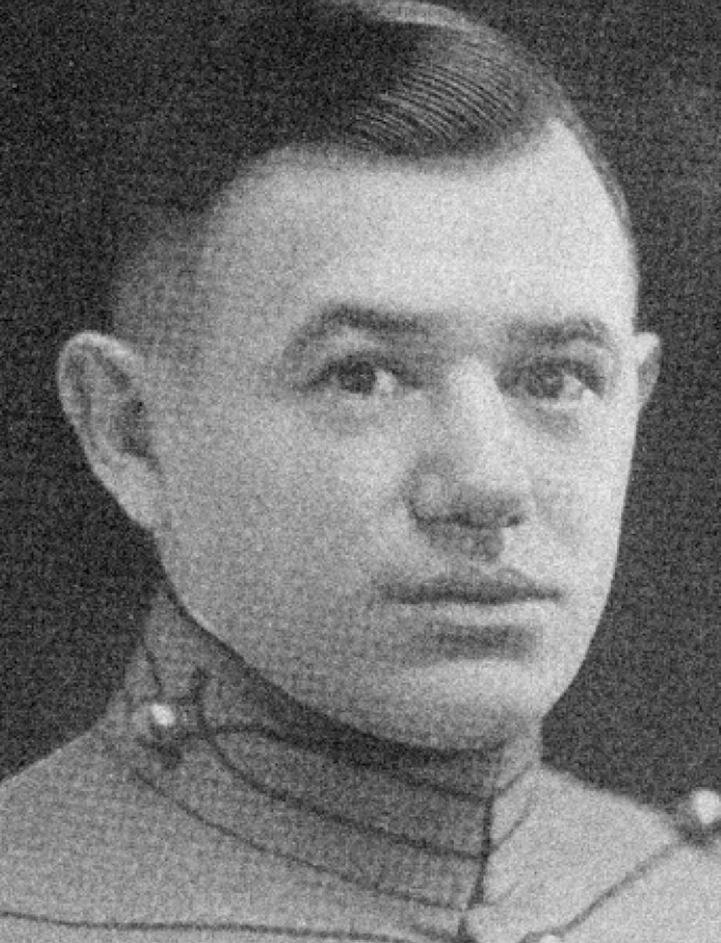 Vincent J. Esposito, shown here as a West Point cadet (U.S. Military Academy Library)
Battle maps themselves are not the problem. Put another way, battle maps depict tactical actions well, but this style of map, when scaled up and out, does a poor job depicting a campaign. Maps of the Battle of Gettysburg from 1 to 3 July 1863 illustrate this basic problem. Without fail, these maps zoom in on familiar features of the battlefield, including Oak Hill and Barlow’s Knoll in the north, McPherson and Seminary Ridges in the west, just beyond Culp’s Hill in the east, and extending to Big Round Top in the south. The town of Gettysburg, usually depicted in a grid, sits in the upper-middle portion, with roads intersecting it from all directions. Depending on the granularity of the tactical detail, units of varying sizes take up their position in the engagement, sometimes depicted by standard markers and sometimes shown in their rough disposition in battle formation. Engaged in combat, units are depicted in line, usually off roads and with an emphasis on the portions of units actually engaged in the fight.
In such renderings, beyond general orientations to basic terrain features and the forces engaged, roads, railroads, and rivers are reduced to second or third positions of importance and serve little purpose. Depictions of reserves, hospitals, ammunition trains, and other supply assets often are neglected entirely, either because they fall outside the scale of the map or because they risk confusing the depiction of frontline fighting. To be sure, battle maps focused on tactical actions impose much-needed clarity on the chaos of combat. They serve a useful and necessary purpose in rendering intelligible the basic contours of an engagement for popular readers and enthusiasts.
However, the virtues of the battle-map standard in the West Point-style atlases became problematic when scaled up and out to depict military campaigns. When warfare expanded out beyond the relatively constrained battlefields of the pre-Napoleonic era into increasingly expansive, protracted, and successive campaigns, mapmakers for popular depictions of wars needed to adjust their maps to match. What they did, in the main, was simply expand the style of battle maps onto wider theaters of war. As a result, units, often of larger size and sometimes even at corps echelon, were depicted as they were on battle maps—using standard unit designations in rough approximation to their place at a given time on the terrain. Rarely, if ever, were such units depicted in their actual formations between engagements, out of contact with the enemy, and moving and maneuvering on campaign (usually in an extended column on a road, or sometimes embarked on trains or flotillas of ships). Furthermore, support elements such as various supply trains or hospital trains almost never made it onto the map. In fact, a good number of larger West Point campaign maps, including those for Gettysburg, did not depict roads at all. As Steele himself acknowledged in his preface to American Campaigns, “Better maps, no doubt, are in existence than many of those reproduced, but the best one available has been taken in every case.”32 In a manner indicative of the difficulty inherent in expanding tactical battle maps to the level of campaigning, Steele wrote, “It has seldom been possible to represent the troops to a scale, the main purpose having been merely to suggest, by means of blue and red blocks, the relative positions of hostile troops on a battle-field or in a theater of operations.”33
The maps contained in Steele’s American Campaigns and the subsequent West Point atlases were and are important and influential but do not represent the totality of operational mapmaking. Plenty of other historical campaign maps have endeavored to fill some of the gaps described above in great detail. Furthermore, the growing scale and complexity of warfare in the twentieth century—including a greater number of joint operations and a significant variety of types of military formations—have made the problem of depicting military campaigns ever more complicated, and there are no simple solutions. But even for the relatively simpler campaigns of the nineteenth century, historians and military professionals never have settled on a clear approach for choosing what elements of a campaign should appear on a map detailing the operational level of war nor how these maps should be depicted. The campaign map style of Steele and the West Point atlases remains the standard.
The Bachelder Maps
The 1863 Gettysburg Campaign offers an excellent encapsulation of the problems described in this article and also serves as an example rich in solutions. Few battles in American military history have been so closely and carefully studied or so thoroughly scrutinized, even in the production of maps depicting the engagement. Indeed, before the guns fell silent in the summer campaign, John B. Bachelder, a civilian artist, started creating a thorough and historically faithful account of the engagement at Gettysburg, even seeking to identify and lay out the location of every unit that participated in the battle.
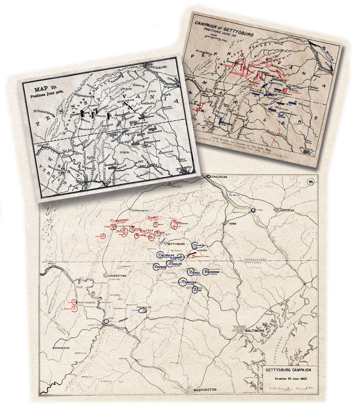 Left: A map from Century Magazine of the Gettysburg area and troop positions on 30 June 1863, produced ca. 1886–1887 (Courtesy of the Wisconsin Historical Society) Right: Matthew Forney Steele's map of Gettysburg, showing troop position on 30 June 1863, produced in 1909 (Courtesy of the Wisconsin Historical Society) Bottom: United States Military Academy Atlas map of the Gettysburg Campaign, 1941 U.S. (U.S. Military Academy)
Days after the battle, Bachelder traveled to Gettysburg to make detailed, written accounts. By the fall of 1863, he had produced his first map of the battle—an isometric map, which would become famous and is still widely reproduced. For the next thirty-one years—the rest of his life—Bachelder meticulously gathered details concerning the great campaign and guided memorialization efforts at what would become Gettysburg National Military Park. In 1880, the War Department commissioned Bachelder to write a history of the battle. He delivered his 4-volume, 2,500-page manuscript—which included 58 maps—in 1886. It never was published. The War Department decided to produce and publish The War of the Rebellion: A Compilation of the Official Records of the Union and Confederate Armies instead, which rendered redundant much of Bachelder’s labor. In 1893, the War Department shipped Bachelder’s manuscript and maps to the Gettysburg Battlefield Commission, and they have been stored in the archives of the national park ever since. In 1997, Morningside House Press published an edited version of his history along with twenty-seven of Bachelder’s original maps covering the events of 1 to 3 July.34 The thirty-one remaining maps of the campaign before and after the battle never have been published but were consulted in researching and writing this article.35
Significantly, Bachelder’s campaign maps were consulted in making the original maps that were used in Century Magazine, which later appeared in Battles and Leaders, then in American Campaigns, and finally in the West Point atlases. Notably, the Century Magazine maps removed roads and depicted major units—army corps and divisions—as unscaled icons floating on the map in their general locations. Most major accounts of the campaign have followed suit with their maps, rarely depicting roads for the campaign, and almost always with units as floating icons.36
Two of the better mapping depictions of the campaign, those found in Edward J. Stackpole’s 1956 They Met at Gettysburg and Edwin B. Coddington’s 1968 The Gettysburg Campaign: A Study in Command, relied on Bachelder’s maps. Both show major units on roads in daily time frames.37 Neither work, however, depicts the movement of units to scale on the march and relative to terrain or in relation to presumed enemy positions and sources of army supply—considerations of paramount importance for a field army commander visualizing those factors and the movement of his forces in time and space.
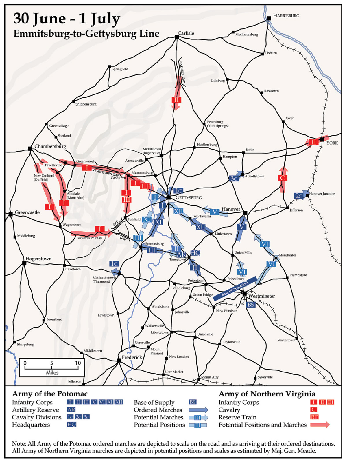
Mapping Meade’s Campaign from 29 June to 1 July 1863
What follows is not a map of the entire Gettysburg Campaign, but rather a snapshot that clarifies the approach to the campaign from Maj. Gen. George G. Meade’s perspective as commander of the Army of the Potomac from 29 June to 1 July 1863. The major pieces in the proverbial field of play are his army headquarters, seven infantry army corps, three cavalry divisions, the Artillery Reserve, his base of supply, and the associated support commands and trains.
The paramount question is this: How did Meade visualize his campaign? Meade and the Army of the Potomac staff, which, under Maj. Gen. George B. McClellan, operated in a manner based loosely on the French model, adhered to the following principles on campaign. The commanding general formed the “general strategical plan.” The chief of staff provided advice “as to the condition of the troops” and “in devising the details.”38 Other responsibilities were as follows:
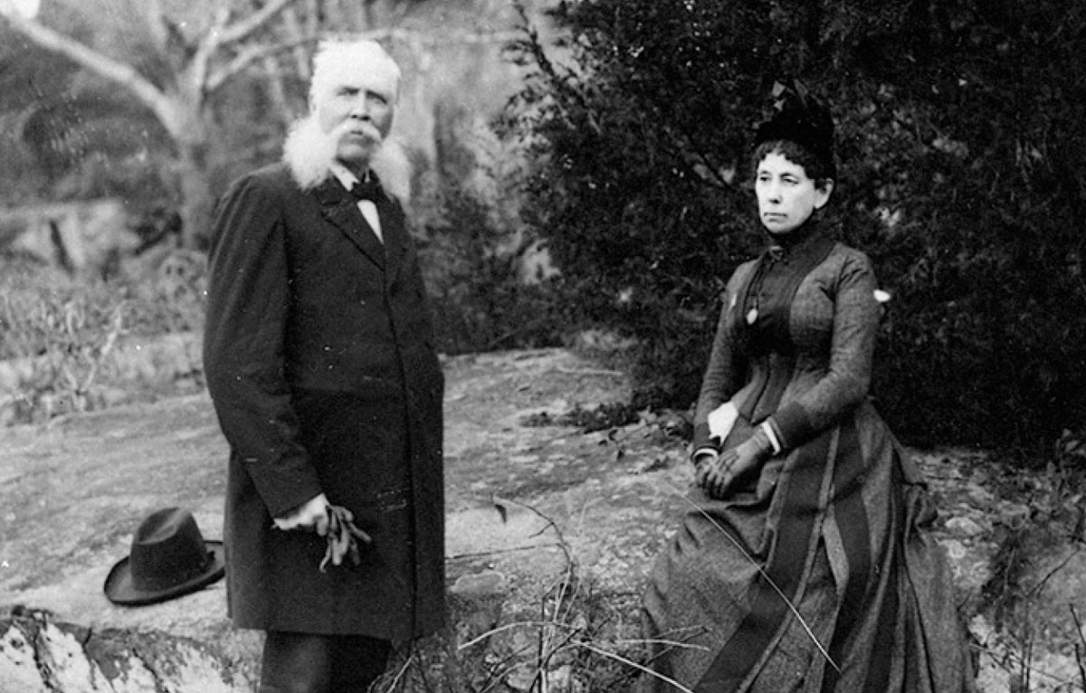 John B. Bachelder with his wife Elizabeth at the Gettysburg Battlefield, ca. 1888 (Courtesy National Park Service, Gettysburg National Military Park, Museum Collection)
His adjutant general’s office must contain full records of the numbers of troops—effective and noneffective—armed and unarmed—sick and well—present and absent, with all reports and communications relative to the state of the army. His quartermaster must have been diligent to provide animals, wagons, clothing, tents, forage, and other supplies in his department; his commissary and ordnance officer, the same in relation to subsistence and munitions—all having made their arrangements to establish depots at the most accessible points on the proposed route of march. His chief of artillery must have bestowed proper attention to keeping the hundreds of batteries of the army in the most effective condition. His chief engineer must have informed himself of all the routes and the general topography of the country to be traversed; he must know at what point rivers can be crossed, and where positions for battle can be best obtained . . . his maps [must be] prepared for distribution to subordinate commanders. His inspector must have seen that the orders for discipline and equipment have been complied with. His medical director must have procured a supply of hospital stores and organized the ambulance and hospital departments. His provost marshal must have made adequate arrangements to prevent straggling, plundering, and other disorders. His aides must have informed themselves of the positions of the various commands and become acquainted with the principal officers, so as to take orders through night and storm with unerring accuracy.39
Additionally, all of the “staff officers at the headquarters of the army [would] organize general arrangements and supervise the operations of subordinate officers of their department at the headquarters of corps.”40
Also, the staff, subordinate units, and other headquarters—adjacent and superior—provided information as to enemy numbers, dispositions, and intentions. Meade needed to be aware, at least in general terms, of all these considerations before he conceptualized his campaign. He also had to create and describe his conceptualization, which, in turn, required a common language for campaign planning, direction, and execution. In the parlance of Civil War generalship, this language was strategy, as expressed in nineteenth-century theoretical works and doctrinal books and manuals. In current military theory and doctrine, this is the terminology of operational art.41 Meade, his subordinate commanders, and their staffs likely possessed some awareness of objectives, strategic points, concentration, lines of communications and supply, lines of operation, interior and exterior lines, bases of operations and supply (including depots), and plans of campaign. For the purposes of this article, two applications of these theories stand out. First, the base of operations functioned less as a single point and more as a line of departure, usually with a single point base of supply behind and protected by the base of operations line. Second, a line (or lines) of operation for a field army were understood as a series of marches by the various corps of an army along two or more parallel roads, all within a single day’s march of each other. Commanders could and generally did distribute their corps laterally (a corps to its own road) and in depth (multiple corps per road). The total lateral disposition of the line or lines of operation formed the front on which an army advanced. The formation of the march on the line of operation depended on numerous factors including terrain features, the availability and quality of roads, and an army’s position relative to the enemy.42
Meade, with his corps commanders and staff, conceptualized his approach in these terms. But when he and his staff issued written orders, they did not always insert the language of nineteenth-century military theory. As a matter of practicality for a vast field army managing numerous moving parts, orders often found expression in simple, practical instructions. For instance, and as a generic example, “Tomorrow morning, march your corps to x town down y road.” But most of Meade’s subordinate officers, especially his most trusted corps commanders, implicitly understood this basic theoretical foundation.
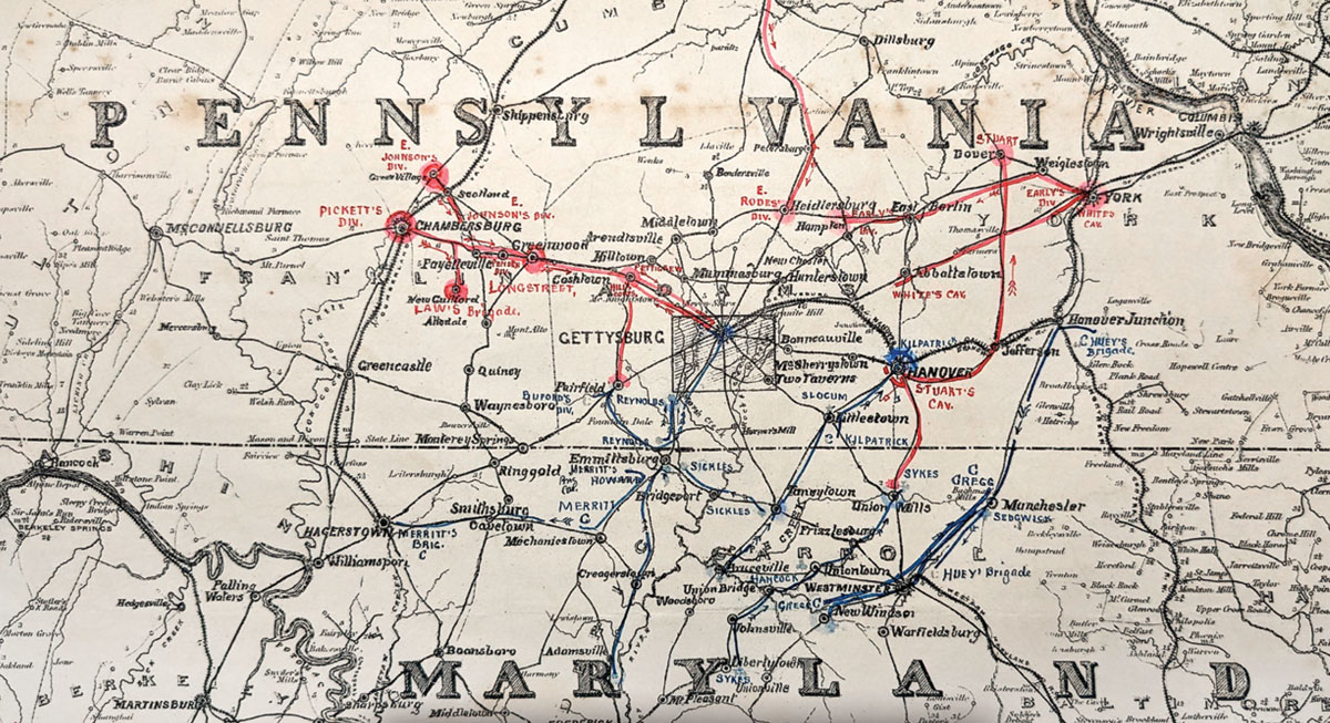 John B. Bachelder's map of the Gettysburg Campaign, which was produced in 1886, depicting the troop movements on 30 June 1863 (Gettysburg National Military Park)
The original maps produced for this article create a visual link between Meade’s concept of the campaign, his orders, and the actions executed by the Army of the Potomac. Everything on these new maps—corps, cavalry, the Artillery Reserve, headquarters positions and dispositions, bases of operation and supply, roads, railroads, mountains and their passes, and enemy positions—reflect what Meade knew and needed to know on 29 June to 1 July for the campaign. Rivers, creeks, bridges, railroad extensions, minor hills, and valleys that were not necessary to Meade’s visualization of the campaign are not on the map. Although rivers and creeks might seem strange omissions, few were obstacles enough to impede marches, in Meade’s view, and none required special bridging or fording efforts.43
Those rivers and creeks that are marked on the map held the potential to serve as fighting positions, offered opportunities for the tactical defense, and were mentioned as such in correspondence to or from Meade. To those who have studied the campaign, the most famous of these in Meade’s defensive planning was Pipe Creek, but Pipe Creek itself is not depicted because it is small and divided and less important as a terrain feature than for identifying a general defensive line, which is depicted. Historians long have noted Marsh Creek, primarily because it marked a resting point for I Corps, especially on its route of march to Gettysburg, but that was not why Maj. Gen. John F. Reynolds mentioned it so often, as the operational map will reveal. Marsh Creek—and Middle Creek, farther to the west—offered potential defensive positions from enemy attacks from the direction of Gettysburg down the Emmitsburg Pike and from the Fairfield and Emmitsburg Gaps.
The depiction of units on the enclosed maps requires explanation. Arrows depicting the seven U.S. Army corps (labeled as I, II, III, and so forth) and the Artillery Reserve (labeled AR) are roughly to their scale on the march. For 29 June and 30 June, the seven corps ranged in size from 9,000 to 14,000 soldiers. With their wagons, these corps consumed 7–9 miles in column on the road. The Artillery Reserve, some 150 guns, took up a similar space on the march. If the corps arrows are shorter for those days, it is because those corps executed a shorter ordered march. Also of note: the Headquarters, Army of the Potomac (depicted on the map as HQ), took up 4–5 miles in column on the road. Its locations are depicted, but not in arrows, because the headquarters tended to move within the arrow depicting the central column of dispersed marches. For 30 June and 1 July, Meade ordered his corps to drop their extra wagons (which usually contained such camp gear as tents) for increased speed and maneuverability in anticipation of battle. The 30 June to 1 July maps thus depict shorter corps marching columns: 4–5 miles of road space. U.S. Army cavalry divisions (depicted as 1c, 2c, and 3c), took up considerably less road space (approximately 2 miles) and moved much faster. All arrows depict the heads of corps and cavalry divisions arriving at their ordered or final destinations for the day.44
 General Reynolds (Library of Congress)
Confederate corps (First, Second, and Third, depicted on the map in red as I, II, and III) in the Army of Northern Virginia constituted much larger formations—roughly 20,000 soldiers each—and, with their wagons, they consumed 14–15 miles of road marching in column. Additionally, the rebels organized and maintained an army-wide Reserve Train (labeled RT) of wagons, which moved with Lt. Gen. Richard S. Ewell’s Second Corps to carry supplies and stores gathered during their invasion of Pennsylvania. Naturally, the Reserve Train grew as Confederates foraged for supplies and captured wagons, and by 1 July, it consumed approximately 14 miles of road. Meade had some idea—though slightly overestimated—of the size of the Army of Northern Virginia, but he did not have precise knowledge of its locations.45 Therefore, rebel columns appear as Meade likely would have visualized them. Lt. Gen. A. P. Hill’s Third Corps and Lt. Gen. James Longstreet’s First Corps are in full columns where Meade’s intelligence placed them at the time. Likewise, Meade knew that Ewell’s Second Corps was split, with two of its three divisions and the Reserve Train in the Cumberland Valley near Carlisle, Pennsylvania, and its third division in the vicinity of York, Pennsylvania. The main Confederate cavalry unit (labeled C) under Maj. Gen. James Ewell Brown “Jeb” Stuart appears larger than the U.S. cavalry because it carried captured U.S. Army wagons from a previous raid.46
The 30 June to 1 July maps thus depict what Meade visualized on 30 June and what he anticipated would transpire on 1 July. First are the ordered marches for the corps and cavalry divisions on 1 July, with the same outlined arrows as the 29 June and 30 June maps. Second are arrows and blocks without outlines to depict where Meade might send his corps, the Artillery Reserve, and his cavalry, depending on General Lee’s actions. The rebel arrows on the 30 June to 1 July maps depict Meade’s visualization of what they could do on 1 July, given his understanding of their positions, movements, and the available roads. In other words, they show what Meade imagined he might do if he commanded Lee’s army.
In all, Meade’s orders and correspondence for the campaign make better sense when depicted on appropriate operational maps. The following is a day-by-day assessment of Meade’s orders and the movement of his army, depicted on corresponding maps.
29 June
Meade assumed command of the Army of the Potomac on 28 June, took stock of the situation, and gave orders for an early march the next day. He had orders to protect Baltimore, Maryland, and Washington, D.C., and act “as the army of operation against the invading forces of the rebels” in order “to give him battle.”47 His army was in position around a base of supply (labeled BS) at Frederick, Maryland, using the Baltimore-Frederick Railroad, and with a base of operations oriented west toward previous Confederate positions in the Shenandoah Valley. Opposing the Federals, the rebels had marched north. One division of Ewell’s lead Second Corps had broken off through the Cashtown Gap toward York, and Ewell’s other two divisions approached Harrisburg, Pennsylvania, through Carlisle.
Meade inherited the army from the position of corps command. He promptly reviewed the status of his army and available intelligence on the enemy and realized that he should move quickly to position the Army of the Potomac between the Army of Northern Virginia and both Baltimore and Washington, D.C. This required a rapid march from positions around Frederick to the north and east, as depicted on the 29 June and 30 June maps. Several aspects of this movement stand out. At least part of Lee’s army (two divisions and the cavalry of Ewell’s corps) already approached the Susquehanna River at Carlisle and York. What remained of Confederate forces were reported to be between Hagerstown, Maryland, and Chambersburg, Pennsylvania, adjacent to three passes through the South Mountain (the western-southern mountain range of the Shenandoah-Cumberland Valley). From south to north, these were the Mechanicstown-Hagerstown Pass, the Monterey Pass, and the Cashtown Gap.48
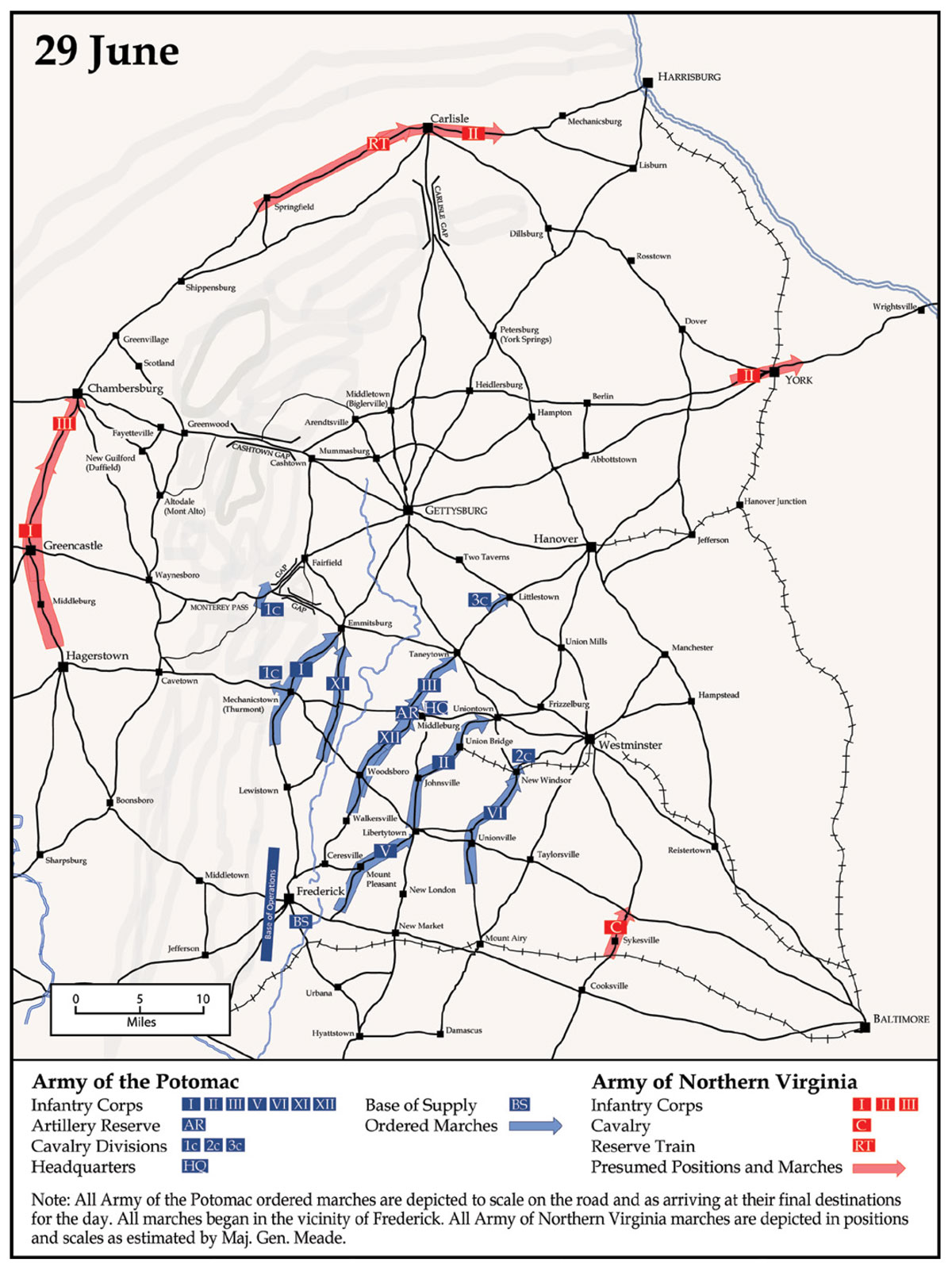
As a result, the Army of the Potomac needed to account for these enemy forces as it moved to protect Baltimore and Washington, D.C., on a vast arc stretching from Hagerstown to the Susquehanna River. Meade also had to consider the size and scale of his army, because its corps, Artillery Reserve, and associated wagons—strung out together on the march—would require nearly 100 miles of road. Combined, these factors meant the Army of the Potomac needed to move far and fast on a broad front.
Meade therefore marched his corps and Artillery Reserve on multiple parallel roads, all oriented generally to the north and northeast, and within a day’s march of nearby corps to allow for swift concentration in the event of enemy contact. The Artillery Reserve, a critical support requirement for any contingent battle, occupied center position in the elongated marching front, along with army headquarters. As depicted on the 29 June map, Meade and his corps commanders settled on five main roads for the seven corps, Artillery Reserve, and two of their cavalry divisions. The other cavalry division, the 1st Cavalry Division under Maj. Gen. John Buford Jr., marched over the pass at Mechanicstown (now known as Thurmont), Maryland, to Cavetown, Maryland, then turned northeast to the center of the Monterey Pass. (One of Buford’s brigades stayed at Mechanicstown to guard that pass.) This movement necessitated other important changes. Meade moved the army’s rail line of supply from the Baltimore-Frederick line to the Baltimore-Westminster line and the base of supply from Frederick to Westminster, Pennsylvania. The changing supply situation and orientation of the army also meant moving the base of operations from its westward-facing line at Frederick to a north-northwest front on a line north of Westminster.49
Meade accepted risks associated with this 29–30 June movement, especially to his lines of supply and communications, base of supply, and base of operations. Rebel General Jeb Stuart had taken some 5,000 troopers, roughly half of Lee’s cavalry, on a raid south of the Army of the Potomac. On 28 June, Stuart’s force had captured a wagon train and cut the telegraph line at Rockville, Maryland, on the supply road between Washington, D.C., and Frederick, thus rupturing communications with Maj. Gen. Henry W. Halleck in the nation’s capital.50 This action made Meade aware of Stuart’s location on 28 June, but Meade only could anticipate where the fast-moving Confederate cavalry might move next. Meade assumed that Stuart would continue on his path around the Federal army to link up with Ewell’s forces on the Susquehanna River. Such a route would take Stuart across the new line of supply from Baltimore to Westminster. It might have inspired a more cautious approach, with Meade sending his army more directly eastward to reestablish communications through Baltimore and to take up defensive positions. Instead, Meade accepted the risk of a rapid march north and northeast. That move offered greater opportunity to seize the initiative—to dictate the terms of action in the upcoming battle—by placing the Army of the Potomac in a central position between the presumed locations of the dispersed Army of Northern Virginia.51
“[The rebels] have a cavalry force in our rear, destroying railroads, etc., with the view of getting me to turn back,” Meade wrote to his wife on 29 June, “but I shall not do it. I am going straight at them, and will settle this thing one way or the other.”52 Meade thus mitigated the risk posed by Stuart (and Ewell’s forces near the Susquehanna River) on 29 June by sending Brig. Gen. David M. Gregg’s 2d Cavalry Division toward Westminster to screen for enemy cavalry, followed by Maj. Gen. John Sedgwick’s large VI Corps to anchor the eastern end of his line against a larger infantry attack.
30 June
In general, Meade’s ordered marches for 30 June were a continuation of what he started on 29 June. That is, as depicted on the map, Meade utilized parallel roads wherever and whenever possible to orient his force to the north and northeast in a dispersed formation that could concentrate and fight in multiple directions. Practically, this meant longer marches for the three corps arrayed farthest east (VI, V, and XII). The three corps arrayed westward (I, XI, and III) made shorter marches. The Artillery Reserve had a medium-length march to resume its central position along with army headquarters. The II Corps remained in place, in a central-rear position where it could function as a reserve in the event of enemy contact anywhere. Federal cavalry divisions remained spread out in a wide arc in advance of their infantry counterparts in the direction of known or possible positions of enemy corps.53
For 30 June, the depiction of Meade’s understanding of enemy movements is of special importance to explaining the movement of his corps. Stuart’s cavalry, burdened with captured wagons and bound northward to find the Army of Northern Virginia, was less of a threat. Indeed, on 30 June, U.S. Brig. Gen. Hugh Judson Kilpatrick’s 3d Cavalry Division fought an indecisive action with Confederate cavalry at Hanover, Pennsylvania. Far more important to Meade were the actions of Ewell’s still divided Second Corps. Reports placed both parts of Ewell’s corps at the river: two-thirds west of Harrisburg and the other one-third at Wrightsville, Pennsylvania, on the Susquehanna River. Spurred onward by panicked politicians and frightened citizens, Meade realized the potential importance of a direct assault on the state capital, but, more importantly, he foresaw only favorable military outcomes from the rebels crossing to the east side of the river. In such an event, Meade was posturing his eastern corps to “fall upon [the enemy’s] rear and give him battle.”54 In fact, Meade seemed more worried about the possibility that Ewell’s corps and other parts of the Army of Northern Virginia might concentrate on the line between Harrisburg and Baltimore, thereby threatening the latter city. This concern explains why Meade pushed two of his three cavalry divisions in that direction, to give word of Ewell turning south toward Baltimore, and with the V, VI, and XII Corps in position to confront such a move.
 Left:General Gregg (Library of Congress) Middle:John Buford Jr., shown here as a brigadier general (Library of Congress) Right:General Sedgwick (Library of Congress)
Meade could not understand what Lee intended for his large First and Third Corps. Meade remained as confident as he could reasonably expect to be that General Hill’s Third Corps held the Cashtown Gap. Meade also knew that General Longstreet, Lee’s only experienced corps commander, commanded First Corps. All of Meade’s intelligence placed Longstreet’s corps at Chambersburg.55 This perplexed the field army commander who carefully had placed his corps on as many different roads as possible, lest these formations become strung out for scores of miles on a single road. As he considered the possible dispositions of the Confederates’ First and Third Corps, Meade foresaw the problem these units would face when they needed to leave the Cumberland Valley and concentrate to the east and south of South Mountain. To move through only one pass or mountain gap would make for a ponderous column more than 30 miles long. Naturally, Meade assumed Lee would use other passes or gaps south of Cashtown, Pennsylvania, and he predicted, reasonably, that Longstreet’s powerful First Corps would move in that direction.56
If the First Corps (or some new reserve unit Meade’s intelligence had not detected) exited the Cumberland Valley through the pass between Hagerstown and Mechanicstown, that unit would fall to the left rear of the advancing Federals and pose a threat to Washington, D.C.57 This was a dangerous but unlikely prospect; nevertheless, Meade placed one brigade of his 1st Cavalry Division at Mechanicstown to provide warning. It seemed more likely that Longstreet would use the Monterey Pass and mountain gap toward Emmitsburg, Maryland, which would also place the First Corps on the west flank of Meade’s formation. Such a contingency might well benefit the Army of the Potomac, but only if it maintained positions that allowed U.S. forces to cover both the Cashtown Gap and the Monterey Pass. To prepare for this, Meade sent I Corps toward Gettysburg to face the rebel Third Corps exiting the Cashtown Gap but kept XI Corps in the vicinity of Emmitsburg to guard the Monterey Pass, with III Corps en route from Taneytown, Maryland, to provide additional protection there.
Even as reliable intelligence continued to confirm the placement of Longstreet’s corps in Chambersburg, Meade worked to account for some version of the Emmitsburg contingency. A small detail on the map helps explain Meade’s thinking. On 29 June, General Buford took two-thirds of his cavalry from Mechanicstown to Cavetown and northeast into the Monterey Pass. They saw no rebel forces and gathered no evidence that placed any significant number of Confederates near the pass. That night, Buford camped on Jack’s Mountain at the southwest end of the Fairfield Gap. The next morning, on 30 June, Buford did not travel the direct route to Emmitsburg to report to General Reynolds, but instead passed through the Fairfield Gap to that town. There he encountered a rebel force belonging to Hill’s Third Corps. Buford disengaged, backtracked to Emmitsburg, and reported to Reynolds. Then Buford moved on to Gettysburg at approximately 1100, encountered Confederate troops—again from Hill’s Third Corps—and again reported that to Reynolds.58
Reynolds, in turn, reported to Meade. His reports were of great importance to the new army commander. Its many corps made the Army of the Potomac unwieldy in terms of command and control and intelligence. Meade had to direct and track these corps and sort through their many reports. The fractured politics of leaders and staffs of the army complicated matters further. Meade, for example, had inherited a chief of staff, Maj. Gen. Daniel A. Butterfield, whom he at once distrusted but chose to retain under the pressing circumstances of the Pennsylvania invasion. Reynolds, who probably received an offer to command the army before Meade, was a subordinate Meade trusted, especially on matters of military judgement. Indeed, on 30 June, he put Reynolds in command of the left wing of the army (I, III, and XI Corps). Meade perceived in Reynolds a highly competent extension of himself, someone who would evaluate the situation with the perspective of a field army—and not merely a corps—commander.59
Thus, on 30 June, Reynolds did more than forward Buford’s report to Meade; he also offered his interpretation of what that intelligence meant and the contingencies it portended. Reynolds did not mention anything about rebels in the Monterey Pass because they were not there. However, and for good reason, Reynolds drew Meade’s attention to Buford’s encounter with enemy forces at Fairfield, Pennsylvania. Like Meade, Reynolds could read a map and visualize the problem rebel forces certainly would encounter if their long formations were confined to one road running from Chambersburg through the Cashtown Gap to Gettysburg. But instead of anticipating that Longstreet might move south on the west side of the mountain and cross through the Monterey Pass, Reynolds foresaw other possibilities. Rebel forces could split off from the Chambersburg Pike after utilizing the gap at Cashtown, where at least four roads ran from north to south, going to Arendtsville, Pennsylvania; Mummasburg, Pennsylvania; Gettysburg; and Fairfield.
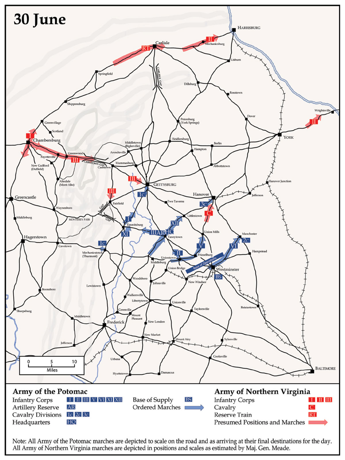
Of course, Meade already knew that rebels had used the Chambersburg-Cashtown-Gettysburg road a few days earlier, when portions of Second Corps went through en route to York, and again that morning, when Buford had encountered an enemy regiment. The Federals reasoned that these Confederates might use one or both of the two northern roads and move toward York. Indeed, Buford told Reynolds that he believed Confederate Lt. Gen. Richard H. Anderson’s division (Third Corps) was on the march to Mummasburg and Berlin, Pennsylvania.60 But what intrigued Reynolds was Buford’s discovery of Hill’s troops at Fairfield marching from the direction of Cashtown.
Like Meade, Reynolds perceived that the rebels put too many troops on the Chambersburg-Cashtown-Gettysburg road to allow for a rapid concentration for battle. These officers anticipated that, to accommodate Longstreet’s First Corps (evidently leaving the Cumberland Valley via the Cashtown Gap), Lee likely would order elements of Third Corps troops off of that road and out of Longstreet’s way. In this light, Buford’s report concerning Anderson’s division made sense. After all, Buford had encountered rebels from the other two divisions of Third Corps at Fairfield and Gettysburg. This implied that Anderson’s was the last of Hill’s divisions. If that unit broke off to the east, there would be sufficient space for Longstreet’s troops to close critical distance in time. But Reynolds disbelieved this contingency and seems to have assumed the rebels were preparing for imminent battle not a concentration eastward. “I do not believe the report of their marching on Berlin, which would lead them to York,” he concluded.61
If the rebels wanted to give battle with First and Third Corps, then utilizing the Cashtown-to-Fairfield road made more sense, especially because Reynolds believed Third Corps was moving in force on Gettysburg on 30 June and 1 July. Anticipating that a Confederate corps would take the aforementioned road, Reynolds wrote a detailed message to Meade:
I think if the enemy advances from Gettysburg, and we are to fight a defensive battle in this vicinity, that the position to be occupied is just north of the town of Emmitsburg, covering the Plank road to Taneytown. He will undoubtedly endeavor to turn our left by way of Fairfield and the mountain roads leading down into the Frederick and Emmitsburg pike, near Mount Saint Mary’s College. [Emphasis added. Today, this juncture is at the intersection of Cashtown, Orrtanna, Fairfield, and Emmitsburg Roads.] The above is mere surmise on my part. At all events, an engineer officer ought to be sent up to reconnoiter this position, as we have reason to believe that the main force of the enemy is in the vicinity of Cashtown, or debouching from the Cumberland Valley above it. [This latter statement probably refers to the southeast-running road to the west of Cashtown—the first split outside of the pass—now known as Bingaman Road.] The corps are placed as follows: Two divisions of the First Corps behind [south of] Marsh Run, one on the road leading to Gettysburg, and one on the road leading from Fairfield to the Chambersburg road at Moritz Tavern [now Bullfrog Road, northwest of the town of Fairplay, Pennsylvania]; the Third Division, with the reserve batteries, is on the road to Chambersburg [now Middle Creek Road], behind [south of] Middle Creek, not placed in position. This was the position [for the I Corps] taken up under the orders to march to Marsh Creek. I have not changed it, as it might be necessary to dispute the advance of the enemy across this creek [from Gettysburg, down the Emmitsburg Pike, with a flanking attack from Fairfield] in order to take up the position behind Middle Creek, which is the one I alluded to near Emmitsburg. [Maj. Gen. Oliver O.] Howard occupies, in part, the position I did last night which is to the left of the position in front of Middle Creek [west of Middle Creek, where it crosses the Taneytown-Emmitsburg road] and commands the roads leading from Fairfield down to Emmitsburg and the pike below. [Emphasis added. The 1858 Adams County map depicts two such roads: (1) What is now County Highway 116 (Fairfield Road) and Pennsylvania Route 16 (Waynesboro Pike) and (2) what is now Tract Road along Flat Run.]62
30 June to 1 July
As operational-level mapping depicts, the focus and vision of a field army commander who is on campaign must be fixed toward the future. Because the commander is out of imminent contact with the enemy, such a future-forward orientation equates to a matter of days. In anticipation of contact with the enemy, this perspective narrows to a matter of hours—usually twelve to twenty-four—while yet accounting for and accommodating the longer view. Thus, commanding on campaign is an inherently complicated endeavor that necessarily requires decisions and orders for numerous contingencies that involve tens—if not hundreds—of thousands of human beings. Any number of small moves and actions that may appear inconsequential in fact produce, in the aggregate, a wholly new situation. Future effects cannot be known in full. Often, there are too many moving parts, and too many weighty elements beyond the control of an individual, to make corrections in real time if a commander’s vision is flawed. Even commanders with a singular ability to anticipate the course and conduct of a campaign are never wholly correct. Factors beyond the commander’s control—weather, errors of subordinates, enemy choices, elements unknowable—inevitably send the situation askew. Gathering accurate intelligence, possessing a common vision, and providing clear direction to communicate a commander’s intent can reduce, but of course never truly eliminate, uncertainty. No wonder so many commanders—in the American Civil War and in other contexts—struggled to command on campaign. Most humans do not possess the capacity to handle what such a command requires. Many become paralyzed, attempting to divine the future and waiting for unattainable certainty.
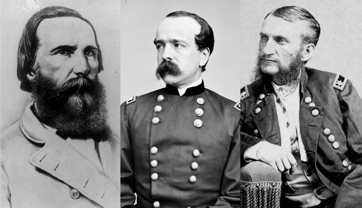 Left:General Longstreet (Library of Congress) Middle:General Butterfield (Library of Congress) Right:Hugh Judson Kilpatrick, shown here as a major general (Library of Congress)
At no time was such complexity more evident than on 30 June, which, for Meade’s purposes and in his sense of time, translated to a focus on the next day: 1 July. From his vantage point on 28 and 29 June, Meade foresaw two broad possibilities for an impending battle. In the first, he would go north and take a central position inside of the rebel forces arrayed in their wide arc from Chambersburg to York. If the Confederate Second Corps tried to cross the Susquehanna, Meade would punish the enemy for splitting its forces and assume the offensive, defeating the enemy corps in detail. Then, Meade could turn and fight what remained of the Army of Northern Virginia in either offensive or defensive action as it exited the Cumberland Valley. Alternately, in the second possibility, and if the enemy did not cross the river but instead concentrated its formations beyond the valley, Meade would find and develop a strong position that the enemy would have to approach and defeat if it was intent on threatening Baltimore or Washington, D.C. Depending on the terrain and his enemy’s disposition, Meade could give battle on the tactical offensive, defensive, or both. In both scenarios, Meade intended to hold at least one corps in reserve to support the attack, to solidify his defensive position, or to counterattack.
On 30 June, Meade’s visualization of the campaign remained fundamentally unchanged, but it attained greater clarity and specificity. Meade anticipated that a major engagement was likely to occur in the next one to three days, and he issued orders that corps should drop extra wagons and that troops should receive ammunition and rations for an impending battle. He also issued a message to his army to boost morale and prepare his command for the fight.63 As the day lengthened, Meade received confirmation that Confederates at Harrisburg and Wrightsville were leaving the Susquehanna River, removing the threat to eastern Pennsylvania and the state capital, and eliminating the possibility of offensive action against enemy forces engaged in a river crossing.64 Meade’s attention therefore turned to the west and the greater threat of Third Corps and, especially, Longstreet’s First Corps, all while trying to ascertain how those enemy forces could effect a linkage with Second Corps, which would be moving south and west from the Susquehanna.
In this context, Meade received and internalized the recent intelligence from Reynolds. In one of the most important documents produced during the campaign, Meade personally wrote Reynolds before noon on 30 June, noting, “We are as concentrated as my present information of the position of the enemy justifies. I have pushed out the cavalry in all directions to feel for them, and so soon as I can make up any positive opinion as to their position, I will move again. In the meantime, if they advance against me, I must concentrate at that point where they show the strongest force.”65
The 30 June to 1 July “option” maps presented here uniquely depict what Meade meant. As June turned to July, Meade correctly perceived that rebel forces confronted two major choices for 1 July. In both cases, Meade recognized that Lee’s main problem remained removing Longstreet’s First Corps from its logjam on the Chambersburg-Cashtown-Gettysburg road. Thus, the first Confederate approach, depicted on the Emmitsburg-Gettysburg Line West map, entailed moving First Corps down the west side of the mountain to the Monterey Pass or splitting Third Corps and First Corps off the road at Cashtown by sending them down the Cashtown-to-Fairfield road. That Confederate forces would use the Monterey Pass seemed increasingly unlikely, but Meade could not afford to dismiss the possibility entirely, because it made sense for Lee to get First Corps on its own road as soon as practicable.66 In the meantime, Reynolds insisted the rebels would move from Cashtown to Fairfield and Emmitsburg. For Meade’s purposes, either path effectively presented the same dilemma: some combination of the Confederate First and Third Corps likely would threaten the left wing of the Army of the Potomac at Gettysburg and Emmitsburg while Second Corps would make longer marches from the vicinities of Carlisle and York. Meade was optimistic, depending on the judgment of Reynolds, that his army would be in a favorable position to fight a battle somewhere along the Gettysburg-to-Emmitsburg line. He also accepted Reynolds’s recommendation and sent Maj. Gen. Andrew A. Humphreys to scout the ground around Emmitsburg for favorable fighting positions, which Humphreys did on 1 July.67
Meade knew the enemy had a second option to prevent Third Corps from impeding the advance of Longstreet’s First Corps. At Cashtown, Lee could move either Third or First Corps off the pike and put it on roads to Mummasburg and Arendtsville, respectively. In that eventuality, Meade surmised, Lee’s intent probably would be to concentrate the Army of Northern Virginia around or to the north and east of Gettysburg. In this scenario, as in the first, Second Corps would move back from Carlisle and York with clearer intent and the threat of effecting a linkage with Third and First Corps, which were marching east.68
How Meade had arranged the corps and Artillery Reserve of the Army of the Potomac, where he positioned these units for marching orders for 30 June, and where he would send them in his orders for 1 July allowed the commander flexible options to counter either enemy approach. Those orders, for the infantry corps and from east to west, retained VI Corps in Manchester, Maryland. Meade put V Corps on the move to Hanover, and XII Corps to Two Taverns, Pennsylvania. The II Corps was to advance to Taneytown to join the Artillery Reserve in center position of the Army of the Potomac, and together they would function as the reserve for any action. Meade ordered III Corps to push west to Emmitsburg, replacing XI Corps, which in turn would move to Gettysburg with I Corps. The cavalry divisions would remain in a wide arc around the army, with the 2d Cavalry Division moving to Hanover Junction, Pennsylvania, the 3d Cavalry Division moving toward Abbottstown, Pennsylvania, and Berlin, the two brigades of the 1st Cavalry Division with Buford spreading out to the west and north of Gettysburg, and the other brigade of that division remaining to guard the pass at Mechanicstown.69
If intelligence gathered during the day indicated a Confederate concentration to the west along the Gettysburg-to-Emmitsburg line, Meade would rely on Reynolds to determine if and where the left wing of the Army of the Potomac would give battle. Throughout 30 June and the early part of 1 July, Meade and Reynolds were careful to position forces to be ready to counter a rebel advance toward either Emmitsburg or Gettysburg. Meade wrote to Reynolds on 30 June, “In case of an advance in force against you or Howard at Emmitsburg, you must fall back to that place, and I will re-inforce you from the corps nearest you, which are [Maj. Gen. Daniel E.] Sickles’, at Taneytown, and [Maj. Gen. Henry] Slocum’s, at Littlestown[, Pennyslvania].”70 Meade gave III Corps, in particular, clear instructions to watch for rebel forces approaching Emmitsburg, and the corps commander, General Sickles, initially left one of his three divisions there to follow that directive, even as he marched his corps to Gettysburg on 1 July.71 Regardless, in the event of a rebel concentration in the west, V, XII, and II Corps, along with the Artillery Reserve, would be in position to move up and concentrate for either defensive or offensive action during the day.72 VI Corps, still in place to defend a potential rebel advance toward Baltimore, would have a longer march, turning it into the army reserve for that contingency.
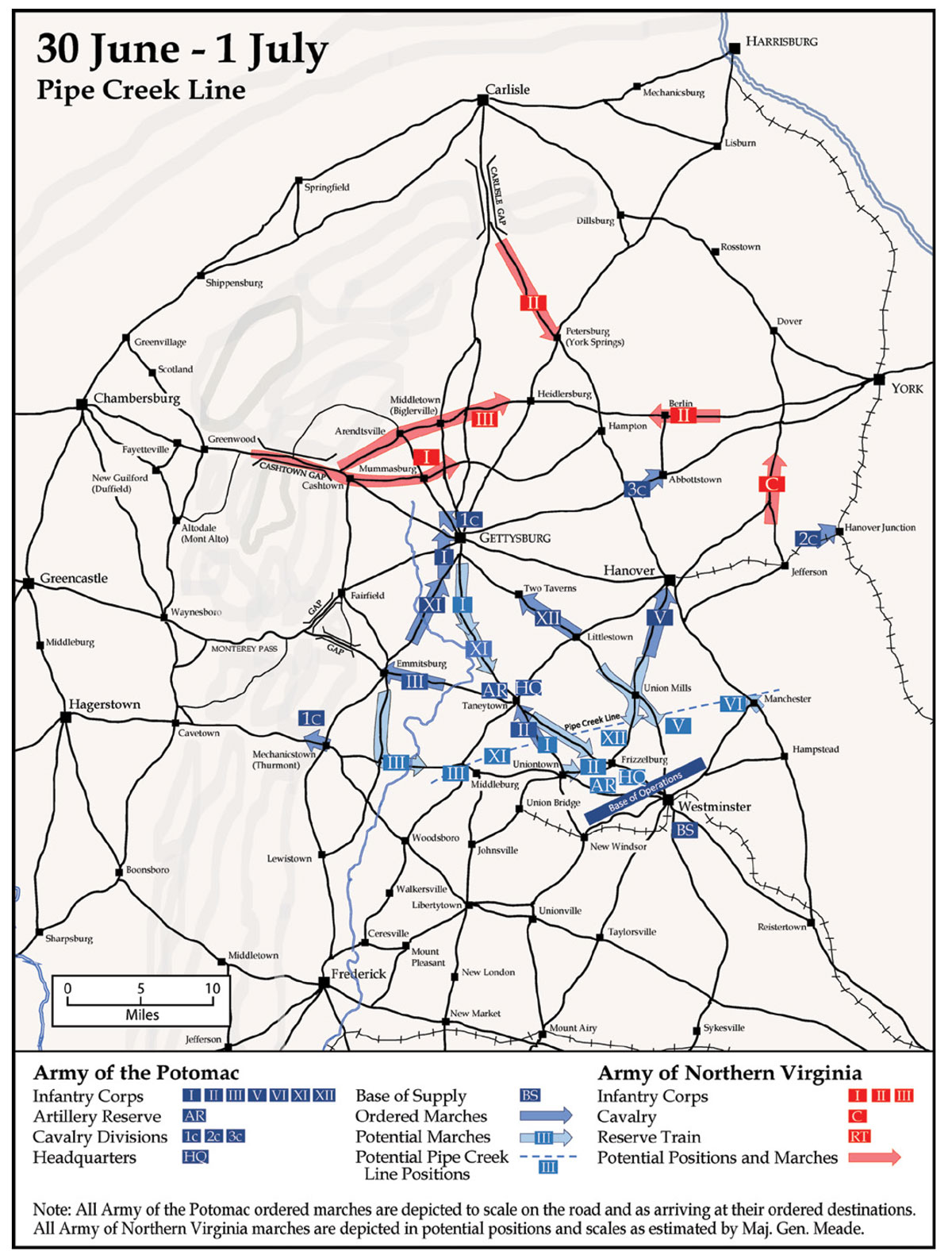
A scenario in which Confederate forces concentrated to the north and east of Gettysburg was more complicated. In their ordered marches for 1 July, the various corps of the Army of the Potomac held a central position. It is possible Federal forces might have found good ground upon which to fight east of Gettysburg, but Meade had neither good intelligence of the ground in that vicinity nor a trusted subordinate like Reynolds to tell him where the army could fight at an advantage. As Meade wrote to Reynolds, “If the enemy is concentrating on our right of Gettysburg, that point would not at first glance seem to be the proper strategic point of concentration for this army.”73 He therefore determined that the best option in the event of an enemy concentration east of Gettysburg was to fall back to prepared defensive positions in northern Maryland. This move would involve reversing the direction for all corps on the march, except for VI Corps, and moving them south. The army was positioned to make this move, but such a march could become confusing, and the roadways congested, so Meade prepared detailed instructions for that contingency. He would issue those instructions—the so-called Pipe Creek Circular—as a provisional order in the late morning of 1 July. Army of the Potomac corps commanders needed to know how to fall back to the Pipe Creek line, but the circular was not an order for corps commanders to execute. Instead, it functioned in today’s parlance as a warning order, not to be executed until Meade issued “notice of such movement.”74
1 July: What Happened
Events on 1 July did not transpire exactly as Meade had envisioned in either broad option, as the 1 July map makes plain. Meade did not anticipate two factors on 1 July. For one thing, Lee—in a manner inexplicable to the Army of the Potomac commander—decided to keep Third Corps and First Corps on the Chambersburg-Cashtown-Gettysburg pike. He neither moved First Corps south to the Monterey Pass, nor split First or Third Corps off from the road at Cashtown, either to the north or south. Though General Hill had in previous days sent forces south on the Cashtown-to-Fairfield road, neither Hill nor Lee made any attempt to use that road on 1 July. Nor does any evidence exist that Lee made an effort to use any of the other roads leaving Cashtown. Moreover, not only did Lee retain First and Third Corps on the road, but on 1 July he and Longstreet also allowed Maj. Gen. Edward “Allegheny” Johnson’s division from Second Corps—along with the Army of Northern Virginia’s Reserve Train—to merge onto the same road between First and Third Corps at Greenwood, Pennsylvania. On 1 July, the Reserve Train alone measured some 14 miles in length. Longstreet’s lead division was ready to march at 0800 on 1 July but did not move past Greenwood until 1600.75
Lee’s decision to allow Johnson’s division (Second Corps) to march ahead of Longstreet’s First Corps made some sense if his intent was to position that division to rejoin the rest of Second Corps on 1 July. But this linkage was possible only because of the rapid movement of Ewell’s other two divisions, and this was the second factor that Meade did not anticipate. On 29 June, upon learning of the Army of the Potomac’s rapid northward movement, Lee ordered Ewell to bring his forces back from the river and to concentrate in the vicinity of Cashtown or Gettysburg. Part of those instructions involved moving one division (Johnson’s) with the Reserve Train back down the Cumberland Valley toward Chambersburg. Ewell’s troops moved quickly, which is why those formations were in position to march between Third and First Corps on 1 July. More importantly, Ewell, whose headquarters were with a division at Carlisle, and Maj. Gen. Jubal A. Early, who commanded Ewell’s other division at York, moved with remarkable speed on 30 June. Both divisions marched some 22 miles and camped east and west of Heidlersburg, Pennsylvania, that night. Thus, both divisions, each on its own road, awoke 10 manageable miles from Gettysburg on the morning of 1 July.76
Meade, not knowing these Confederates would move so fast and so close, sent cavalry toward Berlin on the morning of 1 July “to get the earliest information of the enemy.”77 That enemy would have been Early’s division, but that division was already 5 or 6 miles west of Berlin the night before.78 Had Meade known the true location of this element of Ewell’s Second Corps—two-thirds its full strength—his concern about a rebel concentration at or east of Gettysburg would have been realized.79 In this event, Meade almost certainly would have issued the Pipe Creek Circular as an order. As he wrote to Reynolds on 1 July, “The movement of your corps to Gettysburg was ordered before the positive knowledge of the enemy’s [Second Corps] withdrawal from Harrisburg and concentration was received.”80 Around noon that day, as details of the battle came in and Ewell’s presence was confirmed—but before he had any clear tactical picture of the battlefield—Meade directed Maj. Gen. Winfield Scott Hancock to clear the Taneytown Road to allow Reynolds and I Corps to fall back to the Pipe Creek line.81
Within forty-five minutes, as news of Reynolds’s death arrived, along with reports that I Corps held the town and perhaps occupied good ground for a battle, Meade ordered Hancock to take command in Gettysburg and prepare II Corps to move forward.82 Contrary to what Meade had anticipated, Lee buried Longstreet’s First Corps behind all of Third Corps, Johnson’s division of Second Corps, and the army’s Reserve Train, all on the same road. He allowed Third Corps to enter the action piecemeal. Additionally, the leading divisions of Third Corps sustained frightful casualties attacking Federal forces on 1 July. On the whole, what saved the Army of Northern Virginia from disaster that day were the actions of Ewell on 30 June and 1 July.
Despite the uneven tactical performance of Federal units in the first phase of the fight, Meade’s execution of the campaign put his army in a position of advantage for the battle on all three days. On the morning of 1 July, without knowing where a battle would take place, Meade had positioned four of his seven corps (I, XI, III, XII) and his Artillery Reserve closer in distance to Gettysburg than all but four divisions (those of Maj. Gens. Henry “Harry” Heth, William D. Pender, Robert E. Rodes, and General Early) in the Army of Northern Virginia. Just as important and, again, without knowledge of where a battle would begin, Meade issued marching orders for the day that had six of his seven corps—in addition to his Artillery Reserve—moving closer to the eventual battlefield. Although all of Hill’s Third Corps and all of Ewell’s Second Corps were at Gettysburg by nightfall on 1 July, only two of the three divisions from each corps (the four mentioned above) fought that day.
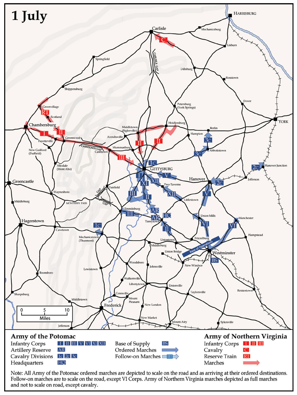
Numbers tell only part of the story, and how Meade had arranged his forces in time, space, and purpose mattered as much as the distance of his formations from Gettysburg. On 1 July, though it used the standard duration of time to move from marching columns into battle lines, Reynolds’s I Corps arrived on the battlefield as one unit, with artillery, because it marched on one road all to itself. This fact helps explain why the numerically inferior Federal corps managed to decimate two divisions from the rebel Third Corps that entered the fight incrementally—almost regiment by regiment. In addition to engaging the Confederate Third Corps, Reynolds’s I Corps even held for a time against the lead elements of Ewell’s Second Corps.
In a similar vein, the arrival of the much-maligned Federal XI Corps—under the command of Maj. Gen. Oliver O. Howard—reflects well on Meade and the oft-criticized XI Corps commander. Meade ordered this unit to Gettysburg in support of I Corps but gave latitude to Reynolds and Howard about how the corps would approach the town. On 1 July, Howard diverted two of his three divisions from the Emmitsburg Road to the Taneytown Road, which facilitated the arrival of XI Corps at Gettysburg as a complete formation.83 It was by prudent choice—not an accidental side effect of a piecemeal arrival—that Howard kept a significant portion of his corps (and, most importantly, his artillery) on key terrain at Cemetery Hill, even as he moved forward the rest of his formations along too wide an arc north of the town.84 Had Confederate divisions under General Rodes and General Early (Second Corps) not arrived so soon, it is entirely plausible that the U.S. Army I and XI Corps alone would have defeated, in detail, all rebel forces available operating under Lee’s design. Even the Federal XII Corps, which did not march as rapidly as it might have, made free use of the Baltimore Pike all to itself, and the arrival of that corps—like the others, all in one piece—later in the day on 1 July allowed Federal commanders to distribute that corps along the line as needed to hold Culp’s Hill, Cemetery Hill, and Cemetery Ridge into the night.
On 2 July, the advantages of Meade’s campaign design came into even fuller and clearer view. Although Meade maintained his concern for some sort of rebel maneuver in the vicinity of Emmitsburg until late in the day on 1 July, he allowed two-thirds of III Corps to proceed to Gettysburg on the open Emmitsburg Road. They arrived by evening, and the remaining division arrived at the battlefield in the early morning. Likewise, on the afternoon and evening of 1 July, Meade ordered II and V Corps to advance from their planned marches toward Gettysburg, he sent the Artillery Reserve forward in two parts from its camp in Taneytown, and he ordered the VI Corps on the east flank of the army at Manchester to begin its grueling march to the battlefield. The II Corps enjoyed complete freedom of movement on the Taneytown Road, with two-fifths of the Artillery Reserve joining the corps on the march. These forces bivouacked a few miles from Gettysburg and arrived on the battlefield between 0730 and 0830 on 2 July. What remained of the Artillery Reserve and the bulk of the army headquarters marched early from Taneytown and arrived at Gettysburg around 1030.85
The Army of the Potomac’s V Corps advanced down the road from Hanover on 1 July, arriving near the vicinity of Gettysburg that evening. Proof positive that Ewell’s Confederate Second Corps moved faster than Meade had anticipated, V Corps found its path toward the town on the Hanover Road blocked by Ewell’s troops. (Critically, the approach of V Corps along this road helped delay the attack of the Second Corps on Culp’s Hill the next day.) The V Corps cut over to the Baltimore Pike and two-thirds of the corps arrived at the battlefield at 0700—the other third arrived around noon—and Meade placed the corps into tactical reserve. Far removed from the field, VI Corps needed to cover a lot of ground—a total of 38 miles—but arrived on the evening of 2 July after a difficult and historic march.
Thus, by midmorning on 2 July, the Army of the Potomac had brought to bear the weight of six of its seven corps, along with its Artillery Reserve, on the battlefield, arrayed those formations in a defensive posture replete with interior lines and a reserve element, and in a position with direct lines of communications to its base. Putting aside the specific tactical actions of 1–3 July, the picture is clear: as an operational commander, Meade put his army in a position to win a critical battle.
Meade’s success stands out all the more when compared to Lee’s performance in positioning the Army of Northern Virginia for the fight at Gettysburg. Lee’s decision to overload the Chambersburg-Cashtown-Gettysburg pike came with severe consequences for the fate of rebel arms in the battle. On campaign in the summer of 1863, Confederate and U.S. Army corps were not created equal. Each rebel corps possessed more than twice the numerical strength of a standard Federal corps and occupied more than twice the amount of space on the road, and, by all accounts, each moved with all its wagon trains in tow on 1 July. Whereas the nimbler, smaller, and combat-ready Federal corps, marching on single roads, could transition—as entire units—from columns into lines quite rapidly, one large rebel corps with its trains, marching on a single road, took hours to arrive on the battlefield and deploy for combat. This was the fate of Third Corps and its lead divisions under Confederate major generals Harry Heth and William Pender on 1 July. The third division (Anderson’s), which started the day at Fayetteville, Pennsylvania, some 18 miles away, “moved leisourly forward” with “frequent halts” in crossing over the mountain pass at the Cashtown Gap.86 This division made it no farther than Herr Ridge, west of town, between 1600 and 1700, where it halted for two hours. This division had ample time to fight, but Lee did not order it into action on 1 July. Lee explained later that “without information” concerning the proximity of the rest of the Army of the Potomac, “the strong position which the enemy ha[d] assumed could not be attacked without danger of exposing the four divisions present, already weakened and exhausted by a long and bloody struggle, to overwhelming numbers of fresh troops.”87
The next Confederate unit in the line of march, Johnson’s division of Ewell’s Second Corps, did not link up with Ewell until just before nightfall. Behind this division, strung out for a considerable distance, was the 14-mile-long Reserve Train. Behind the train came two divisions of Longstreet’s First Corps, which began arriving at Gettysburg in the middle of the night. These delays were the inevitable consequence of Lee’s arrangement of his forces during the campaign. That Lee even had any fleeting tactical opportunities to consider late on 1 July is credited solely to the rapid marches of two Second Corps divisions on 30 June and 1 July, which happened primarily under Ewell’s initiative. Those divisions proved effective because Ewell marched and directed them to the sound of the guns on separate roads, all so they could concentrate almost simultaneously on the battlefield.88
Lee’s poor arrangement came with harsh consequences for the duration of the battle. Heavy casualties sustained by at least three of the four divisions (those of Heth, Pender, and Rodes) fighting far from Lee’s main body on 1 July rendered them essentially combat ineffective for offensive action for the second and third days of the fight, leaving Second and Third Corps with one fresh division apiece (Anderson’s and Johnson’s) to attack on 2 and 3 July. Only Longstreet’s First Corps remained fit for significant action. Its late arrival with only two divisions (those of Maj. Gens. Lafayette McLaws and John Bell Hood) on the night of 1–2 July, 4 miles from the battlefield and 7 miles from its eventual attack points, contributed to the delay of the attack of Longstreet’s corps on 2 July until 1700. Long before that time, Meade had concentrated all available units—VI Corps excepted—for the defense.89 Even that corps arrived near the end of action on 2 July, giving Meade another strong reserve.
And so, on the evening of 2 July, Lee’s only remaining, unengaged unit was the last division of Longstreet’s First Corps, then back at Chambersburg. Maj. Gen. George E. Pickett’s division left Chambersburg at 0200 on 2 July, marched 25 miles, and arrived 3 miles from Gettysburg in the middle of the afternoon heat. Lee ordered it to rest. This division moved into attack positions around 0900 on 3 July. That afternoon, after intense but largely ineffectual artillery fire, Pickett’s division attacked alongside remnants of Hill’s Third Corps, because the Army of Northern Virginia had, after two days’ fighting, expended its offensive capabilities.90 In the meantime, the entire Army of the Potomac was concentrated in even stronger defensive positions than it had held on 1 and 2 July, still with interior lines, and still with an open and developing line of communications to its base.
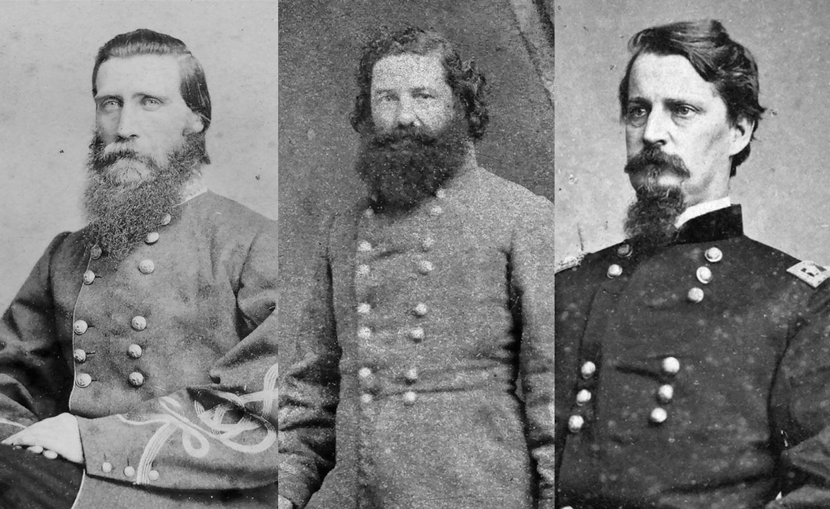 Left:General Hood (Library of Congress) Middle:General McLaws (Library of Congress) Right:General Hancock (Library of Congress)
Military experts often observe, with plenty of examples, that elite tactics cannot overcome bad strategy. But military historians too seldom demonstrate the opposite: that good strategy and operational art can overcome unremarkable tactics. As the enclosed maps help to illustrate, Meade’s superior arrangement of his campaign, understood and ably executed by competent subordinates, gave the Army of the Potomac advantage enough to overcome even its worst tactical mistakes at Gettysburg.
Mapping a Path Forward
As even the relatively simple example of the Gettysburg Campaign demonstrates, operational warfare—moving and fighting large military formations on campaign—is difficult even for competent commanders like George Meade. As a result, operational military historians evaluating the performance of commanders have a difficult task of their own. It is hard enough to describe what happened in a campaign; it is something else altogether to judge how well or poorly commanders fared based on what they knew in the moment. Standard campaign maps—of which the West Point atlas variety are but one common example—are of limited help for the former and inadequate for the latter.
The maps provided here offer new directions for both describing historical campaigns and studying them to understand operational warfare. The 1 July map furnishes an example of a standard historical campaign map that depicts both sides as the armies moved and maneuvered to the battlefield. But this map depicts key terrain—and, critically, roads—in addition to the placement and spacing of formations around that terrain and on those roads. This map also depicts formations that were of critical importance to commanders of both field armies—mainly infantry corps and cavalry divisions—with the notable additions of the Confederate Reserve Train and the Artillery Reserve and headquarters formations of the Army of the Potomac. Any map accompanying a narrative description of what happened in a historical campaign would benefit from these additions.
Effective operational histories seek to evaluate how and why commanders made their decisions. Such evaluation is impossible without seeing how a commander saw the battlespace—that is, how he or she visualized friendly and enemy forces on the ground. The new maps presented here offer great usefulness in four main ways. First, they require historians and students of campaigns to pay careful attention to what field army commanders in charge of campaigns, like Meade, understood about the geography of the operational area. Second, such maps depend on a deeper understanding of what a commander identified as key elements of friendly forces and how that commander visualized those forces moving in space and time. Third, the maps make essential an awareness of how a commander like Meade, in charge of a campaign, saw the enemy at given moments in time—including that commander’s identification of the main enemy commander’s pieces, their placement, and their potential (as much as their actual) movement in space and time. Fourth, maps such as these force students of campaigns to consider how a commander anticipated and intended to adapt to contingencies, chance, and volatility in war. Such considerations are necessary for any accurate evaluation of commanders on campaign.
One major caveat: this article makes no claim for stunning originality. Careful students of the Gettysburg Campaign have noted much of what is depicted here in their narratives, though not with the same emphasis on operational warfare. Important work remains. For the Gettysburg Campaign, similar maps could be drawn from Robert E. Lee’s perspective to provide a more thorough and comparative assessment of his command performance. More importantly, and for all the detail presented here, Gettysburg was a relatively simple, nineteenth-century land campaign. Future studies might apply this style of operational mapping to joint campaigns in the Civil War, and to other sea, air, and joint campaigns in other wars throughout military history.
The future of modernized, comprehensive, operational maps brings this story full circle to the military professionals of the post–Civil War U.S. Army who sought to learn and practice the craft of leading large warfighting formations on campaign. After all, there is a practical and urgent component to operational mapping. If campaigning, as Antoine-Henry Jomini famously wrote, “is the art of making war upon the map, and comprehends the whole theater of operations,” then maps are essential to the art.91 In their time, previous generations of students at the line and staff schools and at the nation’s war college lamented the absence of maps to help them in this important task. Although satellite imagery has improved the depiction of terrain significantly, and other technological improvements have clarified the depiction of friendly and enemy forces, commanders still would benefit from operational maps that better depict how general officers visualized their approaches on campaign. At a minimum, better operational maps of historic campaigns would improve how commanders learn about the unique problems and approaches to campaigning; with luck, they will help future commanders train their minds’ eyes to visualize properly the application of operational art. Such habits may well improve how a new generation of commanders map future campaigns, enabling them to win the nation’s future wars.
Authors’ Note
The authors thank Mr. Russell S. Hartman, Graphics Manager, U.S. Army War College Network Enterprise Center, for his efforts in editing and finishing the newly rendered maps.
Managing Editor’s Note
All contemporary map illustrations in this article are the original work of the authors and are not products of the U.S. Army Center of Military History. We have retained the original spelling, capitalization, and punctuation in quoted materials.
Notes
1. I. B. Holley Jr., General John M. Palmer, Citizen Soldiers, and the Army of a Democracy (Westport, CT: Greenwood Press, 1982), 186.
2. Ibid., 186–87.
3. Arthur L. Wagner et al., Military Geography: Lectures in the Department of Military Art, 1893–1895 (Fort Leavenworth, KS: United States Infantry and Cavalry School, 1895), 4n.
4. Larry I. Bland, ed., George C. Marshall Interviews and Reminiscences for Forrest C. Pogue (Lexington, VA: George C. Marshall Foundation, 1996), 153–56.
5. Hunter Liggett, AEF: Ten Years Ago in France (New York: Dodd, Mead, 1928), 289–92.
6. John A. Lejeune, The Reminiscences of a Marine (Philadelphia, PA: Dorrance, 1938), 188, 303.
7. Timothy D. Johnson, A Gallant Little Army: The Mexico City Campaign (Lawrence: University Press of Kansas, 2007), 25, 27–28, 76–79, 82–83, 85–88, 150, 155, 160–62, 210–12.
8. On the development of military maps generally, see Jeremy Black, Maps of War: Mapping Conflict through the Centuries (London: Conway, 2016), especially 124–30. An example of insufficient maps in the Virginia theater, only 80 miles from Washington, D.C., can be found in Gordon C. Rhea, To the North Anna River: Grant and Lee, May 13–25, 1864 (Baton Rouge: Louisiana State University Press, 2000), 268.
9. Henry J. Hunt, “The First Day at Gettysburg” and “The Second Day at Gettysburg,” in Battles and Leaders of the Civil War, eds. Johnson R. Underwood and Clarence C. Buel, vol. 3 (Secaucus, NJ: Castle, 1982), 273–74, 290–91.
10. See, generally, Earl B. McElfresh, Maps and Mapmakers of the Civil War (New York: Harry N. Abrams, 1999).
11. Emory Upton, The Armies of Asia and Europe (Portsmouth, UK: Griffin, 1878), 221; Bronsart von Schellendorff, The Duties of the General Staff, 4th ed. (London: Harrison and Sons, 1905), 1–42; Black, Maps of War, 121–24.
12. Otto L. Nelson Jr., National Security and the General Staff (Washington, DC: Infantry Journal Press, 1946), 66–69, 78–79, 99, 111, 222.
13. On the controversies of the War Department and General Staff before World War I, see Nelson, National Security and the General Staff, 73–225, and James E. Hewes Jr., From Root to McNamara: Army Organization and Administration, 1903–1963, Special Studies (Washington, DC: U.S. Army Center of Military History, 1975), 3–21.
14. Nelson, National Security and the General Staff, 132–33.
15. Henry Shindler and E. E. Booth, History of the Army Service Schools, Fort Leavenworth, Kansas (Fort Leavenworth, KS: Staff College Press, 1908); Roger S. Fitch, Estimating Tactical Situations and Composing Field Orders (Fort Leavenworth, KS: Army Staff College, 1909).
16. Black, Maps of War, 130–34.
17. Liggett, AEF, 290–91.
18. Ibid.
19. Ibid.
20. On the wide array of maps in World War I, see Black, Maps of War, 152–73.
21. McK. W. Kriegh, “Preparation and Distribution of Maps,” Military Engineer 15, no. 81 (May-Jun 1923): 241–44; D. O. Elliott, “Military Mapping During Modern Military Operations,” (individual research study, Command and General Staff School, 1934), https://cgsc.contentdm.oclc.org/digital/collection/p4013coll14/id/1017; Franklin W. Burch, comp., Preliminary Inventory of the Cartographic Records of the American Expeditionary Forces, 1917–21 (Washington, DC: National Archives and Records Service, General Service Administration, 1966).
22. Matthew Forney Steele, American Campaigns, 2 vols., War Department Document No. 324 (Washington, DC: Byron S. Adams, 1909), iii–v; Matthew F. Steele, “The Conduct of War,” Journal of the Military Service Institution of the United States 42, no. 151 (Jan-Feb 1908): 22–31. Matthew F. Steele’s correspondence with various publishers and authors seeking permission for map reproduction are in his papers at the U.S. Army Heritage and Education Center, Carlisle, PA (hereinafter USAHEC). For the maps from Battles and Leaders of the Civil War, see Corresp, Matthew F. Steele to the Century Company, 23 Mar 1908; Corresp, William Webster Ellsworth, Sec Century Company, to Matthew Steele, 28 Mar 1908; both in Folder: American Campaigns, 1908, Box 19, Matthew F. Steele Papers, USAHEC. On the history of American Campaigns, see Carol Reardon, Soldiers & Scholars: The U.S. Army and the Uses of Military History (Lawrence: University Press of Kansas, 1990), 109–24.
23. Steele, American Campaigns, vol. 1, iii–v.
24. Ibid.; Corresp, Matthew Steele to Thaddeus W. Jones, Gen Staff, 10 Jun 1908, Folder: American Campaigns, 1908, Box 19, Matthew F. Steele Papers, USAHEC.
25. For example, see H. H. S[argent], “Review of American Campaigns,” Journal of the Military Service Institution of the United States 46, no. 163 (May-Jun 1910): 541–42; War Department GO 49, 20 Sep 1916, Reserve Officers’ Training Corps Regulations, 40; War Department GO 61, 11 Nov 1916, Training of Junior Officers of the Corps of Engineers, 6–7; both in General Orders and Bulletins, War Department 1916 (Washington, DC: Government Printing Office, 1917); Dwight D. Eisenhower, At Ease: Stories I Tell Friends (Garden City, NY: Doubleday, 1967), 185–86; Allan R. Millett, In Many a Strife: General Gerald C. Thomas and the U.S. Marine Corps, 1917–1956 (Annapolis, MD: Naval Institute Press, 1993), 90–91; Committee No. 6, [Coast Artillery School], 1926–27, “Campaigns Against Forts Henry and Donelson, February 1862,” Coast Artillery Journal 67, no. 5 (Nov 1927): 389–404; James A. Moss and John W. Lang, Manual of Military Training, vol. 2, Covering R.O.T.C. Advanced Course (Infantry); Blue Course C.M.T.C., and additional matter, 4th ed. (Menasha, WI: George Banta, 1923), ch. 21, 11; “Steele’s American Campaigns,” Infantry Journal 22, no. 6 (Jun 1923): 704; War Department Training Cir 25, 5 Apr 1941, Reading Course for Officers, 2, 5, 7–8, 13, 15, https://www.google.com/books/edition/Training_Circular/YAtJAQAAIAAJ?hl=en&gbpv=1&dq=War+Department+Training+Cir+25,+5+Apr+1941,+Reading+Course+for+Officers&pg=PA1&printsec=frontcover; George C. Marshall, quoted in “Col. Steele Was Veteran of Frontier Wars,” Fargo Forum, 26 Feb 1953, Folder: Clippings: Obituaries, Box 26, Matthew F. Steele Papers, USAHEC.
26. Telg, Helmuth von Moltke to Ch Gen Staff Army, 24 Feb 1910, trans. H. L. Todd, in Ltr to M. F. Steele, 15 Mar 1910, Folder: American Campaigns, 1. Critiques, 2. Acknowledgements of receipts, 1909–1946, Box 19, Matthew F. Steele Papers, USAHEC.
27. Most subsequent editions of American Campaigns were based on a resetting by Infantry Journal Press in 1922, after the original plates from 1909 were destroyed in a fire. The 1922 edition changed each section title from “Lecture” to “Chapter,” and a number of typographical errors occurred along the way. Steele lamented the changes and mistakes. For years, he tried to have them corrected, but with no success. See, for example, Corresp, Matthew Steele to T. Dodson Stamps, 8 Oct 1942, Folder: American Campaigns, 1. Critiques, 2. Acknowledgements of receipts, 1909–1946, Box 19, Matthew F. Steele Papers, USAHEC.
28. Information Relative to the Appointment and Admission of Cadets to the United States Military Academy, Edition 1930 (Washington, DC: U.S. Government Printing Office, 1929), 52–53; Information Relative to the Appointment and Admission of Cadets to the United States Military Academy, Edition 1933 (Washington, DC: U.S. Government Printing Office, 1933), 19; Information Relative to the Appointment and Admission of Cadets to the United States Military Academy, Edition 1939 (Washington, DC: U.S. Government Printing Office, 1939), 18; Corresp, E. F. Harding to Matthew Steele, 5 Feb 1938, Folder: American Campaigns, 1931–42, Box 19, Matthew F. Steele Papers, USAHEC; Henry O. Kelley, “The Social Studies Curriculum at West Point,” The Social Studies 31, no. 5 (May 1940): 221–23; T. Dodson Stamps, “The Department of Military Art and Engineering, U.S.M.A.,” Assembly 10, no. 3 (Oct 1951): 3–5, 12; Arthur P. Wade, “Civil War at West Point,” Civil War History 3, no. 1 (Mar 1957): 5–15.
29. For example, in the Gettysburg Campaign, corps, divisions, and brigade positions on the approach to the battle were in the same general locations but redrawn with new symbology that showed them in camp or bivouac.
30. T. Dodson Stamps and Vincent J. Esposito, eds., Civil War Atlas to Accompany Steele’s American Campaigns (West Point, NY: [no publisher], 1941); Vincent J. Esposito, ed., The West Point Atlas of American Wars, 2 vols. (New York: Frederick A. Praeger, 1959); Stephen E. Ambrose, Duty, Honor, Country: A History of West Point (Baltimore, MD: Johns Hopkins University Press, 1966, 1999), 301–2; Lance Betros, Carved from Granite: West Point since 1902 (College Station: Texas A&M University Press, 2012), 126–39, 367n78.
31. The 30 June map remained the same from the 1941 edition through at least the 1962 second edition of the Vincent J. Esposito volume, but it has disappeared from more recent editions. Thomas E. Griess, ed., Atlas for the American Civil War (Garden City, NY: Square One Publishers, 2002), foreword.
32. Steele, American Campaigns, vol. 1, iv.
33. Steele, American Campaigns, vol. 1, iv–v.
34. David L. Ladd and Audrey J. Ladd, eds., John Bachelder’s History of the Battle of Gettysburg (Dayton, OH: Morningside House, 1997), 9–12.
35. The correspondence relating to the return of John B. Bachelder’s account, along with the bound original draft and maps, can be found in Series III, Official History of the Battle of Gettysburg Manuscripts, Battle of Gettysburg Official History, J. B. Bachelder, c. 1893, Gettysburg National Park Commission, Office of the Commissioners, Records of the Official History of the Battle of Gettysburg, 1880–1893, Box 11, GETT 41120, Gettysburg National Military Park, Gettysburg, PA.
36. For examples, see Wilbur Sturtevant Nye, Here Come the Rebels! (Dayton, OH: Morningside, 1988 [1965]), 126; John W. Schildt, Roads to Gettysburg (Parsons, WV: McClain Printing, 2003 [1978]), 278, 410, 423, 436, 440, 469, 494, 506; Bradley M. Gottfried, Roads to Gettysburg: Lee’s Invasion of the North, 1863 (Shippensburg, PA: White Mane Books, 2001), 129, 151, 190, 210; Noah Andre Trudeau, Gettysburg: A Testing of Courage (New York: HarperCollins, 2002), 117, 128, 139, 142, 151; Stephen W. Sears, Gettysburg (Boston, MA: Houghton Mifflin, 2003), 122, 135; Kent Masterson Brown, Meade at Gettysburg: A Study in Command (Chapel Hill: University of North Carolina Press, 2021), 75, 84, 122.
37. Edward J. Stackpole, They Met at Gettysburg (Harrisburg, PA: Stackpole, 1956), vii–viii, 90, 94–95, endpapers; Edwin B. Coddington, The Gettysburg Campaign: A Study in Command (New York: Charles Scribner’s Sons, 1968), iii–v, 52–53, 180–81, 236–37.
38. C. W. Tolles, “An Army: Its Organization and Movements, First Paper,” Continental Monthly 5, no. 6 (Jun 1864), 715.
39. Ibid.
40. Ibid.
41. Carol Reardon, With a Sword in One Hand & Jomini in the Other: The Problem of Military Thought in the Civil War North (Chapel Hill: University of North Carolina Press, 2012).
42. The most famous such formation is the so-called battalion carré or bataillon carré used by Napoleon Bonaparte in the Jena and Auerstadt Campaign, depicted in David G. Chandler, The Campaigns of Napoleon (New York: Macmillan Co., 1966), 133–201, 467–79. Napoleon used that terminology as a metaphor in instructions to Jean-de-Dieu Soult on 5 October 1806. “You can imagine [the army] marching in this place in a battalion square of 200,000 men.” No one used bataillon carré to describe the formation until after Napoleon’s correspondence was published in the 1860s, after which the French army adopted the terminology to some degree. British military reformers led by Col. F. N. Maude picked up on the concept around the turn of the century. See Henri Plon and J. Dumaine, eds., Correspondance de Napoléon I., tome 13 (Paris: Emperor Napoleon III, 1863), 309–10, and F. N. Maude, The Jena Campaign, 1806 (New York: Macmillan, 1909), 124–27. Nevertheless, the prevailing military theory of the 1860s did account for the concept of marching corps of field armies on parallel roads. See Emil Schalk, Summary of the Art of War: Written Expressly for and Dedicated to the U.S. Volunteer Army (Philadelphia, PA: J. B. Lippincott, 1862), 176–77, and Edouard Delabarre-Duparcq, Elements of Military Art and History, trans. and ed. George W. Cullum (New York: D. Van Nostrand, 1863), 192.
43. It was common practice for corps to camp near creeks in order to get fresh water during marches. But, again, from Maj. Gen. George G. Meade’s perspective as field army commander, because there were so many creeks and small rivers in the route of march, he did not have to consider sources of water for the campaign. Nor did his corps commanders call out such creeks for special attention—their presence was more a matter of tactical standard operating procedure. For more emphasis on geography and waterways in the campaign, see Troy D. Harman, All Roads Led to Gettysburg (Lanham, MD: Stackpole Books, 2022).
44. All estimates of column length are derived from standard returns from the armies and the charts and figures in Rodney C. Lackey, “Notes on Civil War Logistics: Facts & Stories,” U.S. Army Transportation Corps, Fort Gregg-Adams, Virginia, n.d., ca. 2017, https://transportation.army.mil/history/pdf/Peninsula_Campaign/Rodney%20Lackey%20Article_1.pdf (accessed 6 Dec 2023).
45. Meade’s overestimate of the Army of Northern Virginia is a matter of some historical dispute, partly because of unclear rebel accounting for support personnel, many of whom were enslaved people who alone accounted for as many as 10,000 additional people who would have been counted by intelligence sources. Brown, Meade at Gettysburg, 47–48, 56. On estimates of enslaved people in the Army of Northern Virginia, see Kent Masterson Brown, Retreat from Gettysburg: Lee, Logistics, and the Pennsylvania Campaign (Chapel Hill: University of North Carolina Press, 2005), 49–50.
46. Corresp, John F. Reynolds to Daniel A. Butterfield [for George G. Meade], 29 Jun 1863, 3:15 p.m., in U.S. War Department, The War of the Rebellion: A Compilation of the Official Records of the Union and Confederate Armies (Washington, DC: U.S. Government Printing Office, 1889) (hereinafter cited as OR), ser. 1, vol. 27, pt. 3, 397; Corresp, Darius N. Couch to George Meade, 29 Jun 1863, in OR, ser. 1, vol. 27, pt. 3, 407–8. For intelligence estimates throughout the campaign and on 29 June, see Thomas Ryan, Spies, Scouts, and Secrets in the Gettysburg Campaign: How the Critical Role of Intelligence Impacted the Outcome of Lee’s Invasion of the North, June–July 1863 (El Dorado Hills, CA: Savas Beatie, 2015), 391, 393.
47. Corresp, Henry W. Halleck to George Meade, 27 Jun 1863, in OR, ser. 1, vol. 27, pt. 1, 61.
48. See Corresp, George Meade to Henry Halleck, 28 Jun 1863, 7:00am, in OR, ser. 1, vol. 27, pt. 1, 61–62; Corresp, George Meade to Henry Halleck, 28 Jun 1863, 3:00 p.m., in OR, ser. 1, vol. 27, pt. 1, 64.
49. Corresp, George Meade to Henry Halleck, 29 Jun 1863, 11:00 a.m., in OR, ser. 1, vol. 27, pt. 1, 66–67; Orders, HQ, Army of the Potomac, 28 Jun 1863, in OR, ser. 1, vol. 27, pt. 3, 375–76; SO 99, HQ, Cavalry Corps, 29 Jun 1863, in OR, ser. 1, vol. 27, pt. 3, 400–1; Earl J. Hess, Civil War Supply and Strategy: Feeding Men and Moving Armies (Baton Rouge: Louisiana State University Press, 2020), 312–14.
50. Edward G. Longacre, The Cavalry at Gettysburg (Lincoln, NE: Bison Books, 1993), 148–60.
51. Corresp, Meade to Halleck, 29 Jun 1863, 11:00 a.m.
52. George Meade, The Life and Letters of General George Gordon Meade, vol. 2 (New York: Charles Scribner’s Sons, 1913), 13–14.
53. Corresp, George Meade to Darius Couch, 30 Jun 1863, 10:45 a.m., in OR, ser. 1, vol. 27, pt. 1, 67–68; Cir, HQ, Army of the Potomac, 29 Jun 1863, in OR, ser. 1, vol. 27, pt. 3, 402.
54. Corresp, George Meade to Henry Halleck, 30 Jun 1863, 11:00 a.m., in OR, ser. 1, vol. 27, pt. 1, 67.
55. Corresp, Meade to Couch, 30 Jun 1863, 10:45 a.m.; Corresp, George Meade to Henry Halleck, 30 Jun 1863, 4:30 p.m., in OR, ser. 1, vol. 27, pt. 1, 68–69; Corresp, Seth Williams [for George Meade] to Oliver O. Howard, 30 Jun 1863, in OR, ser. 1, vol. 27, pt. 3, 415.
56. For Meade’s ongoing concern about the passes out of the valley, see Corresp, Seth Williams [for George Meade] to Alfred Pleasonton, 30 Jun 1863, in OR, ser. 1, vol. 27, pt. 3, 421.
57. There were some reports that rebel forces under Lt. Gen. D. H. Hill might join Robert E. Lee’s army. Corresp, Darius Couch to [first name unknown] Stanton and George Meade, 29 Jun 1863, 6:20 p.m., in OR, ser. 1, vol. 27, pt. 3, 407–8.
58. Corresp, John Buford to Alfred Pleasonton, 30 Jun 1863; Corresp, John Buford to John Reynolds, 30 Jun 1863, 10:30 p.m.; both in OR, ser. 1, vol. 27, pt. 1, 923–24; Ryan, Spies, Scouts, and Secrets, 402, 406.
59. Corresp, Seth Williams to John Reynolds and Oliver Howard, 30 Jun 1863, in OR, ser. 1, vol. 27, pt. 3, 414–15; Cir, HQ, Army of the Potomac, 30 Jun 1863, in OR, ser. 1, vol. 27, pt. 3, 416–17.
60. Corresp, John Reynolds to Oliver Howard, 30 Jun 1863, in OR, ser. 1, vol. 27, pt. 3, 417.
61. Ibid.
62. Corresp, John Reynolds to Daniel Butterfield [for George Meade], 30 Jun 1863, in OR, ser. 1, vol. 27, pt. 3, 417–18.
63. Cir, HQ, Army of the Potomac, 30 Jun 1863, in OR, ser. 1, vol. 27, pt. 3, 415–17; Corresp, Williams [for George Meade] to Howard, 30 Jun 1863.
64. Ibid. See also the Maj. Gen. Darius N. Couch correspondence for confirmation of rebels leaving Carlisle and York later on 30 June, in OR, ser. 1, vol. 27, pt. 3, 433–34.
65. Corresp, George Meade to John Reynolds, 30 Jun 1863, 11:30 a.m., in OR, ser. 1, vol. 27, pt. 3, 419–20.
66. In addition to Maj. Gen. John Buford Jr. discovering no rebel forces in the Monterey Pass on 29 June, on 30 June, Maj. Gen. Oliver O. Howard reported that a citizen from Waynesboro, Pennsylvania, gave information of no rebels in that town or on the pike from Waynesboro to Emmitsburg. Corresp, Oliver Howard to Daniel Butterfield [for George Meade], 30 Jun 1863, in OR, ser. 1, vol. 27, pt. 3, 421–22.
67. Corresp, Seth Williams [for George Meade] to John Reynolds, 1 Jul 1863, in OR, ser. 1, vol. 27, pt. 3, 460–61. Maj. Gen. Andrew A. Humphreys was a trusted subordinate and Meade’s future chief of staff and, at the time, a division commander in III Corps, which was headed to Emmitsburg anyway. He later reported that the ground was not good for fighting around Emmitsburg. Testimony, Maj. Gen. Andrew A. Humphreys, Battle of Petersburg, 38th Cong. (21 Mar 1864), Report of the Joint Committee on the Conduct of the War, Army of the Potomac (Washington, DC: U.S. Government Printing Office, 1865), 388–91.
68. Corresp, Williams [for Meade] to Reynolds, 1 Jul 1863.
69. Orders, HQ, Army of the Potomac, 30 Jun 1863, in OR, ser. 1, vol. 27, pt. 3, 416. The 1 July marching orders went out late on 30 June, and, because of a communication error, Howard and Maj. Gen. John F. Reynolds did not receive them until the middle of the night. They still had time to arrange their marches and leave between 8:00 and 8:30 a.m.. See Oliver Otis Howard, Autobiography of Oliver Otis Howard, vol. 1 (New York: Baker & Taylor, 1908), 404–8.
70. Corresp, Meade to Reynolds, 30 Jun 1863, 11:30 a.m.. Additionally, Buford, Reynolds, and, later, Maj. Gen. Winfield S. Hancock remained concerned about, and distributed forces to deal with, a rebel approach to Gettysburg on the Fairfield Road. Rpt, Abner Doubleday, 14 Dec 1863, in OR, ser. 1, vol. 27, pt. 1, 244; Corresp, Winfield Hancock to Daniel Butterfield [for George Meade], 1 Jul 1863, 5:25 p.m., in OR, ser. 1, vol. 27, pt. 1, 366.
71. The 30 June and 1 July correspondence is replete with references to positioning and fighting around Emmitsburg, indicating how seriously Meade and Reynolds took that threat. See Corresp, Daniel Butterfield [for George Meade] to Oliver Howard, 30 Jun 1863, in OR, ser. 1, vol. 27, pt. 3, 418; Corresp, Oliver Howard to John Reynolds, 30 Jun 1863, in OR, ser. 1, vol. 27, pt. 3, 419; Corresp, Oliver Howard to Daniel Butterfield [for George Meade], 30 Jun 1863, in OR, ser. 1, vol. 27, pt. 3, 419; Corresp, Seth Williams [for George Meade] to Daniel Sickles, [III Corps], 30 Jun 1863, 12:45 p.m., in OR, ser. 1, vol. 27, pt. 3, 422; Corresp, Daniel Sickles to Seth Williams [for George Meade], 30 Jun 1863; Corresp, Edward Baird [for John Reynolds] to Daniel Sickles, 30 Jun 1863; and Corresp, Daniel Sickles to Edward Baird [for John Reynolds], 30 Jun 1863; all in OR, ser. 1, vol. 27, pt. 3, 424–25; Corresp, O. H. Hart [for Daniel Sickles] to Charles Graham, 1 Jul 1863; Corresp, Daniel Sickles to Seth Williams [for George Meade], 1 Jul 1863, 3:25 p.m.; both in OR, ser. 1, vol. 27, pt. 3, 464; Corresp, Daniel Butterfield [for George Meade] to Daniel Sickles, 1 Jul 1863, 4:45 p.m.; Corresp, George Meade to Winfield Hancock and Abner Doubleday, 1 Jul 1863, 6:00 p.m.; Corresp, Daniel Butterfield [for George Meade] to Daniel Sickles, 1 Jul 1863, 7:30 p.m.; and Corresp, Daniel Sickles to Daniel Butterfield [for George Meade], 1 Jul 1863, 9:30 p.m.; all in OR, ser. 1, vol. 27, pt. 3, 466–68.
72. Corresp, S. F. Barstow [for George Meade] to Henry Slocum, [XII Corps], 30 Jun 1863, in OR, ser. 1, vol. 27, pt. 3, 420–21; Corresp, Seth Williams [for George Meade] to Winfield Hancock, [II Corps], 30 Jun 1863, 1:00 p.m., in OR, ser. 1, vol. 27, pt. 3, 422–23.
73. Corresp, Williams [for Meade] to Reynolds, 1 Jul 1863.
74. Cir, HQ, Army of the Potomac, 1 Jul 1863, in OR, ser. 1, vol. 27, pt. 3, 458–59.
75. Lafayette McLaws, “Gettysburg,” Southern Historical Society Papers 7, no. 2 (Feb 1879), 67.
76. Scott L. Mingus Sr. and Eric J. Wittenberg, “If We Are Striking for Pennsylvania”: The Army of Northern Virginia and the Army of the Potomac March to Gettysburg, vol. 2 (El Dorado Hills, CA: Savas Beatie, 2023), 257–58, 295–98. On the movement of rebel units 29 June–3 July, see Gottfried, Roads to Gettysburg, 191–223; Schildt, Roads to Gettysburg, 357–534.
77. Corresp, Alfred Pleasonton to David Gregg, 1 Jul 1863, 6:30 a.m., in OR, ser. 1, vol. 27, pt. 3, 469. According to Maj. Gen. Alfred Pleasonton’s report, on 2 July they even sent Brig. Gen. Hugh J. Kilpatrick’s 3d Cavalry Division “toward Gettysburg from the direction of Heidlersburg, to prevent the enemy from concentrating his forces by that road.” Because Maj. Gen. Jubal A. Early was already at Gettysburg, there were not many enemy forces left to concentrate. Rpt, Alfred Pleasonton, 31 Aug 1863, in OR, ser. 1, vol. 27, pt. 1, 914.
78. On 30 June 30, General Kilpatrick of the 3d Cavalry Division reported to Alfred Pleasonton after the battle at Hanover with Maj. Gen. James E. B. Stuart’s cavalry that “a strong column of the enemy’s forces left York at daybreak this morning,” and that they were “concentrating at Gettysburg.” He added that he thought there was “a considerable force at Berlin.” Corresp, Hugh Kilpatrick to Alfred Pleasonton, 30 Jun 1863, in OR, ser. 1, vol. 27, pt. 1, 987. A little later he said he had “information that Lee’s headquarters are at Berlin,” to which Pleasonton added the endorsement that “General Lee’s being in Berlin is important.” Corresp, A. J. Alexander to Alfred Pleasonton, 30 Jun 1863, in OR, ser. 1, vol. 27, pt. 1, 987–88. Later that afternoon, when Buford accurately reported that Lee was at Chambersburg, Pleasonton noted that “this information contradicts Kilpatrick’s, of Lee being at Berlin.” Corresp, Buford to Pleasonton, 30 Jun 1863. Between the news of the battle at Hanover, Kilpatrick’s lack of specificity about the forces leaving York or being in Berlin, the unlikely rumor that Lee was at Berlin, and Pleasonton’s poor judgment in emphasizing that rumor, the important information that Early was moving quickly west seems to have been lost on Meade.
79. At midnight on the night of 30 June– 1 July, after he had issued his marching orders for 1 July, Meade reported to Maj. Gen. Henry W. Halleck that “[Lt. Gen. Richard S.] Ewell is massing at Heidlersburg,” the phrasing of which indicates that Meade thought Ewell’s corps was on the way to Heidlersburg, not already there, which would be consistent with Buford’s reports (see note 71). Corresp, George Meade to Henry Halleck, 1 Jul 1863, 12:00 a.m., in OR, ser. 1, vol. 27, pt. 1, 70–71.
80. The War of the Rebellion: A Compilation of the Official Records of the Union and Confederate Armies includes a captured order from General Early to an unidentified colonel (probably cavalry) with these instructions: “Get between Gettysburg and Heidlersburg, and picket at Mummasburg and Hunterstown, [Pennsylvania]. Send in direction of Gettysburg, and see what is there, and report to General Ewell at Heidlersburg.” The document is dated 30 June 1863, and Buford says it “was captured last night on the road to Oxford, [Pennsylvania]. The bearer of it said he saw Early last at Berlin.” Despite its location in the 30 June correspondence, it almost certainly was captured the night of 30 June–1 July, and Buford forwarded it the morning of 1 July. Orders, Maj. Gen. Jubal A. Early, 30 Jun 1863, in OR, ser. 1, vol. 27, pt. 3, 414. Likewise, two reports from Buford (one to Reynolds and another to Pleasonton) dated 30 June, 5:30 a.m., and 12:20 p.m., in the Official Records are almost certainly from 1 July. The information therein matched the situation on 1 July, not 30 June, including the 5:30 a.m. note describing sending parties toward Mummasburg, “due north,” and Littlestown—all three were directions from Gettysburg, not the Monterey Pass, which is where Buford was on the morning of 30 June. In addition, the due north party “captured a prisoner from [Maj. Gen. Robert E.] Rodes’ division,” 3 miles out. If true, that only could have been on the Carlisle or maybe Heidlersburg Roads on the night of 30 June–1 July. Rpt, John Buford, 30 Jun 1863, 5:30 a.m.; Rpt, John Buford, 30 Jun 1863, 12:20 p.m., both in OR, ser. 1, vol. 27, pt. 1, 922. See also Rpt, John Buford, 27 Aug 1863, in OR, ser. 1, vol. 27, pt. 1, 927; H. P. Moyer, ed., History of the Seventeenth Regiment Pennsylvania Volunteer Cavalry (Lebanon, PA: Sowers Printing, 1911), 59–63; and Newel Cheney, History of the Ninth Regiment, New York Volunteer Cavalry (Jamestown, NY: Martin Merz & Son, 1901), 101–7. The most compelling case for the misdating of these three documents is that Buford includes none of that information in his 30 June 10:30 p.m. report to Reynolds, reporting instead that he captured a courier from Lee near Heidlersburg, who said, “Ewell’s corps is crossing the mountains from Carlisle,” with the Rodes division in the lead at Petersburg, Pennsylvania. At that point, he only had “rumors and reports” of Early’s division approaching from York. He made a similar report to Pleasonton. Corresp, Buford to Reynolds, 30 Jun 1863, 10:30 p.m.; Corresp, John Buford to Alfred Pleasonton, 30 Jun 1863, 10:40 p.m.; both in OR, ser. 1, vol. 27, pt. 1, 923–24. Meade probably referred to the misdated dispatches from when they actually arrived on 1 July in his note to Reynolds that morning, writing, “the various movements reported from Buford, seem to indicate the concentration of the enemy either at Chambersburg or at a point situated somewhere on a line drawn between Chambersburg and York, through Mummasburg and to the north of Gettysburg.” Corresp, Williams [for George Meade] to Reynolds, 1 Jul 1863.
81. Corresp, Daniel Butterfield [for George Meade] to Winfield Hancock, 1 Jul 1863, in OR, ser. x, vol. 27, pt. 3, 461. Meade made a similar assessment to John Sedgwick. Corresp, George Meade to John Sedgwick, 1 Jul 1863, in OR, ser. 1, vol. 27, pt. 3, 462.
82. Corresp, Butterfield [for George Meade] to Hancock, 1 Jul 1863, 1:10 p.m. and 1:15 p.m..
83. Corresp, Oliver Howard to John Reynolds, 1 Jul 1863, 6:00 a.m.; Corresp, E. C. Baird [for John Reynolds] to Oliver Howard, 1 Jul 1863; both in OR, ser. 1, vol. 27, pt. 3, 457.
84. Corresp, Oliver Howard to George Meade, 1 Jul 1863, 2:00 p.m., in OR, ser. 1, vol. 27, pt. 3, 457–58.
85. Rpt, Robert O. Tyler, 30 Aug 1863, in OR, ser. 1, vol. 27, pt. 1, 871–72.
86. Eric A. Campbell, “‘Sacrificed to the bad management … of others’: Richard H. Anderson’s Division at the Battle of Gettysburg,” High Water Mark: The Army of Northern Virginia in the Gettysburg Campaign, Programs of the Seventh Annual Gettysburg Seminar (Gettysburg, PA: National Park Service, 1999), 107.
87. Ibid.
88. If Lee had ordered Lt. Gen. James Longstreet’s corps to march on 30 June from their positions around Chambersburg to the Monterey Pass as Meade feared, and if Longstreet’s troops had moved as far as Ewell’s that day (22 miles), they would have made it to the east side of the pass. On the morning of 1 July, they would have been on the east side of the mountain, on their own roads, 12 miles from Lt. Gen. A. P. Hill’s corps at Cashtown, 11 miles from Gettysburg, and 6 miles from Emmitsburg.
89. Arguably, the Army of the Potomac would have been in a better defensive position on 2 July had the rebels attacked earlier, before Maj. Gen. Daniel E. Sickles moved III Corps forward and out of line.
90. Lesley J. Gordon, General George E. Pickett in Life & Legend (Chapel Hill: University of North Carolina Press, 1998), 108–20.
91. Baron Antoine-Henri de Jomini, The Art of War, trans. G. H. Mendell and W. P. Craighill (Philadelphia, PA: J. B. Lippincott, 1862), 69.